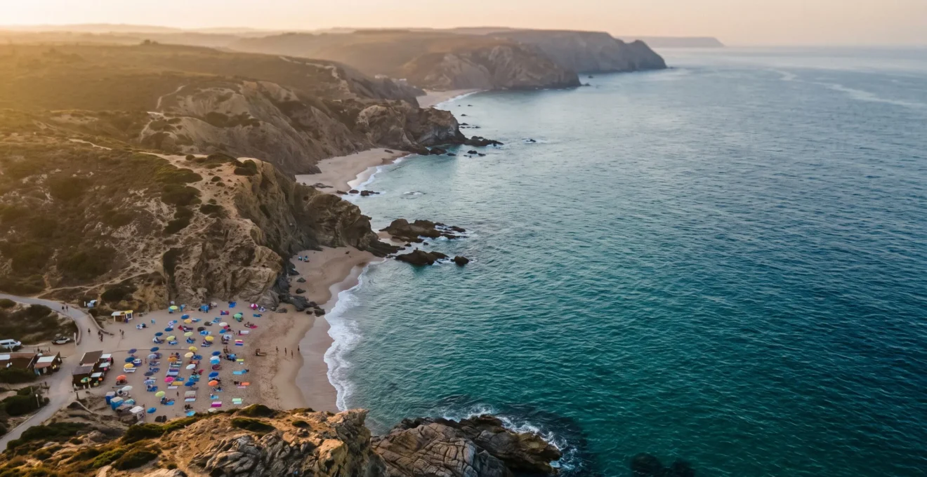
The frustrating sight of a crowded beach is a conscious choice, not a coastal necessity.
- Crowd concentration is a predictable psychological habit tied directly to convenience and easy access points, creating over-tourism hotspots.
- Mastering tidal charts and understanding local geology reveals safe, empty coves that are physically inaccessible or simply overlooked by the majority.
Recommendation: Stop searching for named “secret spots” and start learning the skills to read the coastline and discover your own private havens.
There’s a familiar image for any coastal lover: a stunning stretch of shoreline, shimmering under the sun, but so packed with towels, umbrellas, and people that the sand is barely visible. We’ve all felt that pang of disappointment, the sense that the wild beauty we came for has been lost in the crowd. The common reaction is to search for articles listing “hidden gems” or “secret beaches,” hoping a map will lead to salvation. But this approach only perpetuates the cycle, turning yesterday’s secret into tomorrow’s hotspot.
The conventional wisdom is to go early, avoid holidays, or walk a bit further from the car park. While these tips have merit, they only scratch the surface. They treat the coastline as a static map of destinations to be consumed. But what if the real key to solitude wasn’t about finding a different spot on the map, but about learning to read the map’s terrain in a fundamentally new way? The truth is, the coast is a dynamic, living system governed by psychology, tides, and geology. Understanding these forces is the real skill of a coastal explorer.
This guide isn’t another list of locations to geotag. It’s a transfer of insider knowledge. We will deconstruct the reasons crowds cluster, teach you how to achieve ‘tidal literacy’ for safe exploration, and reveal how geology itself can create more rewarding experiences. By learning to see the coast not as a series of car parks and paths but as a system of opportunities and constraints, you unlock the ability to find your own secluded space, anytime.
To navigate this journey from crowded shorelines to your own private cove, we’ve structured this guide to build your skills progressively. You will learn to understand the patterns of others before mastering the patterns of the sea itself.
Summary: Why Most People Miss Out on the Best Coastal Spots
- Why Psychological Herd Behaviour Keeps Crowds Clustered Near Car Parks
- How to Identify Safe Coves Using Tide Charts and Local Harbour Advice
- Pebble Coves vs Sandy Hideaways: Which Offers Better Snorkelling Clarity?
- When to Arrive at Hidden Beaches Before Day-Trippers Discover Them
- The Tide Misjudgement That Strands Visitors in 40% of Rocky Coves
- How to Identify the Best Atlantic-Facing Viewpoints for Wave Meditation
- Why Volcanic Rock Absorbs Solar Heat and Radiates Warmth Into Trapped Water
- Why Lava Pools Maintain 2°C Warmer Temperatures Than Open Ocean
Why Psychological Herd Behaviour Keeps Crowds Clustered Near Car Parks
The first rule of finding solitude is understanding why it’s so rare. The answer lies less in geography and more in human psychology. We are creatures of convenience, and this instinct creates a powerful phenomenon of psychological clustering. Most people will unconsciously settle at the first acceptable spot they find, typically within a few hundred metres of a car park or main access path. The path of least resistance becomes a funnel, concentrating 90% of visitors onto just 10% of the available space. This isn’t a conscious decision; it’s a default setting driven by a desire to minimize effort.
This effect is massively amplified by social media. The act of geotagging transforms a location from a place into a product to be consumed. As a location gets tagged repeatedly, it triggers a feedback loop, drawing more and more visitors who want to replicate the same photo. A prime example is Arizona’s Horseshoe Bend, which went from a quiet overlook to a littered, overcrowded attraction largely due to its photogenic nature being shared with a specific location tag. It demonstrates how a single digital pin can focus thousands of people onto one precise spot, leaving adjacent, equally beautiful areas completely empty.
It’s geotagging specific locations that can drive overtourism.
– Natural Habitat Adventures editorial team, 3 Reasons to Stop Geotagging Travel Photos on Social Media
This desire for the “perfect photo” can even override basic safety instincts. For instance, recent RNLI-commissioned research reveals that 37% of Gen Z beachgoers would risk standing at the water’s edge for a picture. This mindset is a gift to the solitude-seeker. While the crowds are competing for the same clichéd shot near the entrance, vast, untrodden territories lie just a ten-minute walk away, beyond the invisible boundary of convenience.
How to Identify Safe Coves Using Tide Charts and Local Harbour Advice
Once you’ve decided to walk past the crowds, your primary tool for discovery and safety becomes the tide. Ignoring it is not an option; mastering it is a superpower. Attaining tidal literacy means you don’t just “check the tide times” on an app; you understand how the water will behave in the specific landscape you’re exploring. A secluded cove at low tide can become a dangerous trap a few hours later as the water returns, cutting off your exit.
Your planning should always start with a reliable tide chart, noting the times for high and low water. But charts alone are not enough. Local knowledge is paramount, especially in areas with a large tidal range. As an extreme example, the coastline of Jersey in the Channel Islands demonstrates this perfectly. According to local sea safety advice, the difference between high and low water can be up to 12 metres. The sea can rush in faster than a person can run, turning a simple walk around a headland into a life-threatening situation as water floods in from behind, cutting off the path back to shore.
This is why visiting a local harbour master’s office, a dive shop, or even an old fisherman’s pub can yield more valuable safety information than any website. Ask them about specific coves, hidden currents, and how quickly the tide comes in around certain headlands. They possess the ground-truth knowledge that turns a dangerous gamble into a calculated adventure. This local intel, combined with your own diligent planning, is the formula for safely unlocking the coast’s best-kept secrets.
Your Pre-Exploration Safety Checklist
- Identify Risks: Before setting out, learn to spot rip currents, which are a leading cause of drowning and often hard to see.
- Check Tide Times & Heights: Always verify the tidal schedule for the day, as heights and times change and can easily catch you out.
- Understand Wave Behaviour: Familiarize yourself with how waves work; their patterns and power can be dangerous if misjudged.
- Avoid Alcohol: Be aware that a significant number of coastal deaths are linked to alcohol consumption, which impairs judgment and coordination.
- Seek Local Knowledge: Consult with harbour masters or local experts about specific dangers like fast-rising tides or hidden currents in the area you plan to explore.
Pebble Coves vs Sandy Hideaways: Which Offers Better Snorkelling Clarity?
Your choice of hidden cove affects more than just the feeling underfoot; it dramatically influences the quality of the water itself, a crucial factor for photographers and snorkelers. The debate between pebble and sand is a matter of geological advantage. While sandy beaches offer soft comfort, they are often the enemy of water clarity. The finer the sand, the more easily it becomes suspended in the water with even the slightest wave action, creating a cloudy, milky environment.
This is especially true in shallow, enclosed bays where water circulation is limited. The constant movement of small waves, or even the kicking of swimmers, can keep fine silt and sand particles airborne in the water column for hours. This suspension scatters light and significantly reduces visibility, making underwater photography or observing marine life a frustrating experience. A seemingly pristine sandy hideaway can have surprisingly poor underwater clarity.
In contrast, pebble coves are a snorkeler’s paradise. The weight and size of the stones mean they are not easily disturbed by wave action. Water can wash over them without churning up sediment. Any particles that are dislodged quickly settle back to the bottom, leaving the water column exceptionally clear. This stability creates an ideal environment for underwater visibility, allowing sunlight to penetrate deeper and revealing the vibrant colours of marine flora and fauna. For those seeking to capture the underwater world with a camera, a pebble beach almost always offers a superior effort-to-reward ratio.
When to Arrive at Hidden Beaches Before Day-Trippers Discover Them
Timing your arrival is as critical as choosing your location. The majority of beachgoers, or “day-trippers,” operate on a predictable schedule, typically arriving between 10 AM and leaving by 4 PM. Your goal is to exist outside these peak hours. However, simply “going early” isn’t the full strategy. The secret is to synchronize your arrival with both the sun and the tide to maximize your window of solitude.
The most obvious times to avoid are public holidays and school holidays. As HM Coastguard incident data shows, their 36,000 annual callouts peak during these periods, reflecting the sheer volume of people on the coast. Your best opportunities will always be on a weekday outside of the main tourist season. But even on a busy August weekend, solitude is achievable. The first “golden hour” for explorers is sunrise. Arriving as the sun comes up grants you several hours of peace before the first day-trippers even pack their cars.
The second, more strategic window is the late afternoon, but this requires careful tidal planning. Remember that the high tide is about 50 minutes later each day. This means you can use the tide to your advantage. For example, if a hidden cove is only accessible for three hours on either side of low tide, and low tide is at 4 PM, the crowds who arrived in the morning will be long gone. You can arrive in the late afternoon and enjoy the cove in beautiful evening light, knowing the returning tide that deters others is precisely what guarantees your privacy. The tides change fastest midway between high and low, so be acutely aware of your timing during this phase. This is strategic solitude in action.
The Tide Misjudgement That Strands Visitors in 40% of Rocky Coves
The very force that carves out beautiful, secluded coves—the tide—is also the greatest danger for the unprepared explorer. The single biggest mistake is underestimating the speed and power with which the sea can reclaim the shore. It’s a risk that is tragically common. Shockingly, one water-safety analysis found that 40% of coastal drowning incidents occur when people aren’t even planning to be in the water. They are simply walkers or explorers caught out by a rapidly rising tide.
This happens because of a fundamental lack of tidal literacy. People venture out onto sandbanks or around rocky headlands at low tide, completely unaware that their return path will be submerged within an hour or two. They become stranded, facing the terrifying choice of being swept away by waves or attempting to scale unstable cliffs. An all-too-common scenario is highlighted by a rescue of seven tourists, including children, in Australia. They set out on a walk and were trapped on a cliff as the tide surged in, making their path back impassable. This is the stark reality of misjudging the coast’s rhythm.
The root of the problem is a widespread lack of understanding. This isn’t just an anecdotal issue; it’s a documented phenomenon that poses a significant risk to the public.
Alarming RNLI research published in 2025 showed four in ten people lack a ‘basic understanding’ of how tides work, with approximately 15 per cent of respondents reporting having been cut off, or nearly cut off, by the tide at some point in their lives.
– RNLI (Royal National Lifeboat Institution), Float to Live campaign research, via Marine Industry News
Before entering any cove that looks like it could be cut off, you must know three things: the time of the last low tide, the time of the next high tide, and a pre-identified, safe exit route. Set an alarm on your phone for the “turnaround time”—the absolute latest you must leave to guarantee a safe return. Never assume you can “outrun” the tide. The reward of solitude is only worth it if you return safely to tell the tale.
How to Identify the Best Atlantic-Facing Viewpoints for Wave Meditation
Sometimes the goal isn’t to be *on* the beach, but to find a vantage point *above* it. The reward for a steep climb to a coastal headland isn’t just a panoramic photo; it’s an opportunity for what can be called wave meditation. This is the practice of finding a safe, solitary spot to simply sit and watch the rhythmic, hypnotic swell of the open ocean. It’s an experience that connects you to the raw power and immense scale of the sea.
The best viewpoints for this are almost always on Atlantic-facing coastlines, where long-period swells, born from storms thousands of miles away, roll in with a powerful, mesmerizing consistency. Look for promontories or clifftops that jut out into the sea, offering an uninterrupted 180-degree view. These locations provide a sense of being surrounded by the ocean, enhancing the immersive experience. Use satellite imagery on mapping apps to identify these potential headlands before you even leave home. Look for small trails leading away from main coastal paths.
The ideal spot has two key features: a safe, flat area to sit, well back from the cliff edge, and an orientation that faces directly into the prevailing swell. The sound is as important as the sight; the deep, resonant boom as waves meet the cliffs below is a core part of the meditative experience. This isn’t about the chaotic chop you find in a sheltered bay, but the deep, orderly pulse of the ocean. Finding such a spot requires effort—often a challenging hike—but the reward is a profound sense of peace and perspective that no crowded beach can ever offer.
Why Volcanic Rock Absorbs Solar Heat and Radiates Warmth Into Trapped Water
Not all coves are created equal, and one of the most remarkable geological advantages you can find is a natural pool formed from dark, volcanic rock. The secret to their magic lies in a simple principle of physics: heat absorption. The dark colour of basalt or lava rock gives it a very low albedo, meaning it reflects very little sunlight. Instead, it absorbs a huge amount of solar energy throughout the day.
Think of it like the difference between wearing a white shirt and a black shirt on a sunny day. The black shirt gets significantly hotter because it absorbs more light energy and converts it into heat. Volcanic rock does the same on a massive scale. All day long, it soaks up the sun’s rays, building a reservoir of thermal energy within the stone itself. This is a stark contrast to pale limestone or chalk cliffs, which reflect most of the sun’s energy back into the atmosphere.
When the tide comes in and fills these rock pools, a heat exchange begins. The stored warmth in the rock slowly radiates out into the trapped water. This process acts like a natural heating system, gently raising the temperature of the pool. Because the water is contained, this warming effect is concentrated, unlike in the open ocean where any warmth quickly dissipates. This is the scientific explanation behind the delightful experience of finding a surprisingly warm pocket of water on a cool day.
Key Takeaways
- Crowds follow convenience: True solitude begins where the easy path ends. Exploit the predictable clustering of people near access points by consciously walking past them.
- The tide is a tool: Don’t just check the tide; learn its daily rhythm. Use it to unlock access to coves when others have gone home and to ensure your own safe return.
- Geology dictates experience: The type of rock determines water clarity for snorkelling (pebbles are better) and even water temperature (dark volcanic rock creates warmer pools).
Why Lava Pools Maintain 2°C Warmer Temperatures Than Open Ocean
The practical result of volcanic rock’s heat-absorbing properties is a tangible and luxurious reward for the discerning explorer. Natural lava pools, filled by the high tide and then isolated as the water recedes, can consistently maintain a temperature that is up to 2°C warmer than the surrounding open ocean. This might not sound like much, but it makes a significant difference to the swimming experience, transforming a chilly dip into a pleasant, prolonged soak. It’s the coastline’s version of a natural spa.
This temperature difference is most noticeable in the late afternoon or early evening. After a full day of absorbing solar radiation, the dark rocks are at their peak thermal capacity. As the evening air begins to cool, the warm rock continues to radiate heat into the water, creating a beautifully inviting microclimate. This is when you can find yourself floating in a pool of tranquil, warm water while the sea just a few feet away feels bracingly cold. It’s a moment of pure coastal magic, engineered by geology.
Finding these pools requires combining all the skills of a coastal explorer. You need to use satellite maps to identify promising rock formations, consult tide charts to know when the pools will be full but isolated, and be willing to scramble over terrain that deters the average beachgoer. The effort involved ensures these spots remain secluded. The reward is an unforgettable experience: your own private, naturally heated swimming pool, enjoyed in total solitude as the sun sets over the ocean.
Now that you understand the forces that shape both the crowds and the coast itself, you possess the keys to true solitude. Start planning your first genuine coastal exploration today, and trade the packed sands for a piece of the shore that feels like it’s yours alone.