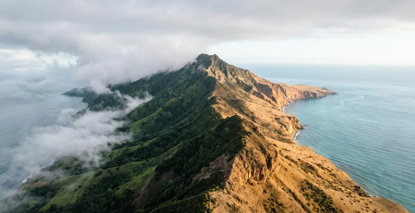
For weather-sensitive travellers, a generic forecast for Tenerife is useless. The island’s weather isn’t random; it’s a predictable system governed by the interplay of trade winds, altitude, and island orientation. This article decodes these forces, empowering you to become your own micro-forecaster and strategically choose your location—whether you’re seeking guaranteed sunshine on the coast or mystical cloud forests in the mountains—for the perfect day trip.
You’ve checked the forecast for your trip to Tenerife, and it shows a week of generic sun-and-cloud icons with a temperature of 22°C. Yet, when you arrive, you might find the north coast shrouded in mist while the south basks in brilliant sunshine just an hour’s drive away. This frustration is common for travellers who treat the island as a single climatic entity. The standard advice—”pack layers”—is a symptom of this misunderstanding, not a solution.
The truth is, Tenerife doesn’t have weather; it has *weathers*. The island is a continent in miniature, not just in landscape, but in its complex and varied atmospheric conditions. The key isn’t to guess or to react to the weather but to understand the engine that drives it. But what if the secret wasn’t just knowing that the north is different from the south, but understanding precisely *why* it is, and how to use that knowledge to your advantage?
This guide abandons generic advice and instead provides a meteorological toolkit. We will dissect the three primary forces—the trade wind engine, the dramatic effect of altitude, and the island’s physical orientation—that create this climatic mosaic. By understanding these principles, you can move from being a passive victim of the forecast to an active strategist, capable of predicting where the sun will be, where the clouds will form, and how to pack for a day trip that might span three distinct climate zones.
To navigate this island of climatic contrasts, this guide breaks down the meteorological forces at play and provides practical tools for planning your daily adventures. Explore how altitude and wind combine to create remarkably diverse environments just kilometres apart.
Summary: Why Volcanic Islands Create Continent-Scale Climates
- Why Altitude and Ocean Exposure Create 6 Distinct Climate Zones in 50km
- How to Predict Localised Weather Using Altitude and Trade Wind Patterns
- Coastal Sunshine vs Mountain Mist: Which Microclimate Suits Your Daily Mood?
- When Morning Clouds Dissipate in High-Altitude Zones: The Hourly Breakdown
- The Packing Mistake That Leaves 70% Unprepared for Sudden Temperature Drops
- Why Each Island Evolved Distinct Microclimates Despite 100km Proximity
- Why Volcanic Islands Compress Continental-Scale Diversity Into 2000 Square Kilometres
- Why Tenerife Contains More Ecosystem Types Than Entire European Countries
Why Altitude and Ocean Exposure Create 6 Distinct Climate Zones in 50km
The concept of “Tenerife weather” is a fallacy. Instead, one must think in terms of vertical climate stacking. A journey from the coast to the summit of Mount Teide isn’t a horizontal trip of 50km, but a vertical ascent through multiple, distinct ecosystems. The primary drivers are altitude and the island’s exposure to the moisture-laden trade winds. The northeast-facing slopes act as a natural barrier, forcing incoming air to rise, cool, and release its moisture. This creates a lush, humid climate on the north side, while the south and west remain in a dry, sunny “rain shadow”.
This stark contrast is not merely anecdotal; it is measurable. The northern coastline receives significantly more precipitation and has fewer overall sunshine hours compared to its southern counterpart, resulting in dramatically different landscapes and temperatures. This division is the most fundamental rule of the island’s climate system, a direct result of its volcanic topography interacting with oceanic wind patterns.
The following data illustrates just how profound this difference is, creating two entirely different holiday experiences on one small island. As this comparative analysis of North and South Tenerife shows, the choice of location dictates the climate you will experience.
| Zone | Annual Rainfall | Sunshine Hours/Year | Temperature vs South |
|---|---|---|---|
| South Coast | Low, mostly dry | ~320 sunny days/year | Baseline (warmest) |
| North Coast | 300–400mm, mostly Oct-March | 2,000–2,500 hours/year | 3–5°C cooler year-round |
This table confirms the island’s climatic split personality. The south offers a classic, arid, sun-drenched environment, while the north provides a more temperate, green, and varied atmosphere. Understanding this basic north/south, windward/leeward dynamic is the first step to mastering your travel plans and escaping the crowds who simply follow the generic forecast.
How to Predict Localised Weather Using Altitude and Trade Wind Patterns
The secret to predicting Tenerife’s weather lies in understanding the “trade wind engine” and the phenomenon of orographic lift. The consistent northeast trade winds, blowing across the Atlantic, arrive saturated with moisture. As this moist air hits the mountainous spine of Tenerife, it is forced to ascend. As it rises, it cools, and its water vapor condenses into a vast sea of clouds, known locally as the “panza de burro” or “donkey’s belly”. This is not a random weather event; it’s a predictable physical process.
This cloud formation is remarkably consistent. The moisture-laden air typically condenses within a very specific altitude band. As an analysis of Teide’s sky explains, the trade winds condense their humidity in a specific band between 600–1,800 metres above sea level. This means if you are below 600 metres on the north coast, you might be under a grey sky. But if you drive up through the cloud layer, a remarkable transformation occurs. You emerge into brilliant, clear sunshine, with a blanket of white clouds stretching out beneath you.
This effect is so reliable that it becomes a predictive tool. Cloudy morning in La Orotava? Drive up towards Teide National Park, and you will almost certainly break through the clouds into a different world. As the Dark Skies Atlas eloquently puts it in its guide to stargazing on the island:
You drive up through grey stratus and emerge into clear sky.
– Dark Skies Atlas, Stargazing in Tenerife: Teide National Park Dark Sky Guide
This isn’t luck; it’s meteorology. The cloud sea forms a “lid”—a thermal inversion layer—that traps the moisture below, ensuring the high-altitude zones above 2,000 metres remain exceptionally dry and clear. By knowing the altitude of this inversion layer, you can literally choose to be above or below the clouds on any given day.
Coastal Sunshine vs Mountain Mist: Which Microclimate Suits Your Daily Mood?
Tenerife’s microclimates offer more than just a variety of temperatures; they offer a variety of moods. Your frustration with a cloudy morning on the north coast can be transformed into an opportunity by simply choosing an activity that matches the environment. Do you crave the energy of bright sunshine and the vibrant blue of the ocean? Or does your mood call for the quiet, contemplative solitude of a misty, ancient forest? On Tenerife, you can choose.
For days when high-energy and warmth are the goal, the southern coast is the logical, reliable choice. With its arid climate and vast rain shadow, areas like Costa Adeje or Los Cristianos offer a near-guarantee of sunshine. This isn’t an exaggeration; the south consistently provides the classic “sun and sea” vacation experience, making it the perfect antidote to the cooler, more humid conditions often found elsewhere on the island.
But to dismiss the cloud-covered north is to miss the island’s soul. The moisture from the trade winds sustains the incredible laurel forests of the Anaga and Teno Rural Parks. Walking through these ancient forests, with mist swirling through the trees and moss hanging from every branch, is an otherworldly experience. It is a mood of quiet wonder and deep connection to nature that the southern beaches simply cannot offer. Here, the clouds are not a nuisance; they are the lifeblood of a unique and precious ecosystem.
Higher still, the experience changes again. Rising above the cloud sea into the volcanic caldera of Teide National Park offers a feeling of profound tranquility and awe. You are literally on top of the world, looking down on a white ocean of clouds. The air is crisp, thin, and silent. This is a landscape for introspection, for feeling small against the scale of nature. The choice is yours, every single day: descend for coastal energy, stay for forest magic, or ascend for mountaintop serenity.
When Morning Clouds Dissipate in High-Altitude Zones: The Hourly Breakdown
The “sea of clouds” is one of Tenerife’s most iconic natural spectacles, but its behaviour is not static. It follows a predictable daily pattern, or diurnal cycle, driven by the sun’s energy. For travellers wanting to experience this phenomenon, understanding its hourly rhythm is key to being in the right place at the right time. Typically, the cloud layer is most compact and stable during the night and early morning when temperatures are cooler.
As the morning sun begins to heat the island, two things happen. The air below the inversion layer warms up and starts to rise, causing the base of the clouds to lift and sometimes become turbulent. Simultaneously, the sun’s radiation begins to “burn off” the top layer of the cloud sea, causing it to gradually dissipate or retreat, especially around the edges of the main mountain ranges. This means that viewpoints that were offering a perfect, uninterrupted sea of clouds at 8 AM might have a completely different, patchier view by midday. The prime time for seeing the most solid and photogenic cloud sea is often between sunrise and mid-morning.
Conversely, in the late afternoon and towards sunset, as the land begins to cool again, the inversion layer can strengthen and the cloud sea often reforms, becoming more dense and expansive. This makes sunset a spectacular time to be at a high-altitude viewpoint, watching as the clouds flow back into the valleys below you, painted in the warm colours of the setting sun.
Case Study: The Predictable Phenomenon at High-Altitude Viewpoints
The existence of dedicated viewpoints, or ‘Miradores’, confirms the reliability of the sea of clouds. For instance, the Mirador de la Tarta del Teide, located above La Esperanza, is one of the most famous spots for observing this spectacle. The fact that similar, well-known viewpoints exist on other high-altitude Canary Islands like La Palma, El Hierro, and Gran Canaria proves that this is a predictable, repeatable meteorological event tied to island topography, not a rare stroke of luck for tourists.
So, the hourly breakdown is simple: for the classic, solid sea-of-clouds view, go high and go early. For dramatic, colourful, and dynamic cloudscapes, aim for the late afternoon. By timing your visit to the mountain passes, you can witness the daily breath of the island’s weather engine.
The Packing Mistake That Leaves 70% Unprepared for Sudden Temperature Drops
The single biggest mistake a weather-savvy traveller can make in Tenerife is dressing for a single location. Leaving your hotel in Costa Adeje where it’s a balmy 25°C in shorts and a t-shirt for a trip up to Teide is a classic rookie error. The power of adiabatic cooling—the process where air cools as it rises—is a force to be reckoned with. For every 100 metres you ascend, the temperature drops by approximately 1°C. A journey from sea level to Teide’s cable car station at 3,555 metres can involve a staggering temperature drop of over 20°C, even before factoring in wind chill.
Many visitors are caught completely off guard. They might pack a light sweater, assuming it will suffice, only to find themselves shivering in near-freezing conditions at altitude, especially if they stay for sunset. The wind at these elevations can be relentless, making it feel significantly colder than the thermometer reading suggests. As guides on the mountain often warn, temperatures at high altitude can drop below 10 degrees Celsius even on a sunny day due to wind.
This isn’t about being prepared for rain; it’s about being prepared for a completely different thermal environment. The air at high altitude is also much drier and the UV radiation is far more intense. Sunburn and dehydration are as much a risk as hypothermia. The solution is not to pack a huge suitcase, but to pack smart, using a modular, zone-based system for any day trip that involves a significant change in elevation.
Action Plan: Your Zone-Based Packing Checklist for a Single Day Trip
- Beach Bag (0-500m): Keep swimwear, sandals, and light layers like a linen shirt or sarong for the hot, sunny coastal zones. High-factor sunscreen and a hat are non-negotiable here.
- Transition Layer (500-1800m): Have a light raincoat or a windproof shell jacket easily accessible. This is the “cloud zone” where you might encounter mist, drizzle, or cooler, damp conditions.
- Summit Kit (1800m+): This is your core high-altitude gear. A warm fleece or insulated jacket, long trousers, closed-toe shoes, a beanie, and even light gloves are essential, especially for evenings. A beach at 24°C can mean near-freezing temperatures at the top of Mount Teide an hour later.
Thinking of your car as a “base camp” for these three kits allows you to adapt instantly, ensuring comfort and safety as you navigate the island’s vertical world.
Why Each Island Evolved Distinct Microclimates Despite 100km Proximity
The principles of orographic lift and rain shadows are not unique to Tenerife; they are the defining features of the entire Canary Islands archipelago. However, the intensity and variety of microclimates on each island are directly proportional to its maximum altitude and overall topography. The taller and more rugged an island, the more powerful its ability to intercept the trade winds and create diverse ecosystems. This is why not all Canary Islands are created equal when it comes to climate.
Tenerife, with Spain’s highest peak, Mount Teide (3,718m), and La Palma with Roque de los Muchachos (2,426m), are the masters of climate creation. Their significant height acts as a formidable barrier to the trade winds, forcing massive amounts of air upwards and creating the dramatic north-south divide. This process results in everything from lush laurel forests on their northern slopes to arid, desert-like conditions in the south and unique high-mountain ecosystems above the cloud line.
In stark contrast, the eastern islands of Fuerteventura and Lanzarote are much older, more eroded, and significantly lower in altitude. Fuerteventura’s highest point is a mere 807 metres. This relative flatness means the trade winds often flow over them with less interruption. While they still experience some localized effects, they lack the dramatic verticality needed to create the rich tapestry of microclimates found on Tenerife or Gran Canaria. Their climates are more uniform: predominantly arid, windy, and sunny across the entire island. Height, therefore, is the secret ingredient that dictates an island’s climatic complexity. The World Heritage Datasheet for Teide National Park notes that it has the most diverse high-mountain ecosystem of any Atlantic island, a direct result of its extreme altitude.
This explains why a traveller seeking the lush, green hiking trails of a laurel forest would choose Tenerife, La Gomera, or La Palma, while someone prioritising expansive, sandy beaches and consistent wind for water sports would be better served by Fuerteventura. Each island’s geology has predetermined its climatic personality.
Why Volcanic Islands Compress Continental-Scale Diversity Into 2000 Square Kilometres
The rapid and extreme changes in altitude on a volcanic island like Tenerife create a phenomenon known as “ecological compression”. In a continental landmass, you would need to travel thousands of kilometres, from the Mediterranean coast to the Alps, to experience the same range of ecosystems that Tenerife packs into a mere 50km transect from coast to summit. This vertical journey is a shortcut through multiple latitudinal zones of life.
At sea level, you find coastal vegetation adapted to salt spray and arid conditions, similar to other subtropical regions. As you ascend into the northern hills, the trade wind moisture supports a lush, temperate laurel forest (laurisilva), a relic ecosystem that covered much of Southern Europe millions of years ago. Above this, a belt of Canary Island pine forest thrives, adapted to cooler, drier conditions. Finally, above the tree line (around 2,000 metres), you enter the high-mountain ecosystem of Teide National Park, a seemingly barren but incredibly specialized world of unique shrubs and plants adapted to extreme temperatures, intense solar radiation, and volcanic soils.
This compression of distinct habitats is not just an observation; it is a recognized ecological fact. An assessment by the IUCN confirms that this compression of ecosystems is measurable, as it identifies eleven Habitats of Community Interest, covering 75% of the territory of the park. Each of these zones, with its unique combination of temperature, humidity, and soil, provides a niche for different species to evolve in isolation.
This is the magic of oceanic islands: they are laboratories of evolution. The isolation of the island itself, combined with the micro-isolation of its various climate zones, creates a powerful engine for biodiversity. Species that arrive on the island can adapt and specialize to fit a particular ecological niche—the misty forest, the dry pine woods, or the harsh summit scrub—eventually becoming entirely new species found nowhere else on Earth.
Key Takeaways
- Tenerife’s weather is a system: The northeast trade winds are the engine, bringing moisture to the island’s northern and eastern slopes.
- Altitude is a climate-creator: As air is forced up the mountains (orographic lift), it cools, forming the famous “sea of clouds” and releasing rain, leaving the south in a dry “rain shadow”.
- You can predict the weather: A cloudy morning in the north almost always means clear skies in the south or above the cloud layer in Teide National Park.
Why Tenerife Contains More Ecosystem Types Than Entire European Countries
The statement that a small island of just 2,034 square kilometres contains more biodiversity than some entire countries seems hyperbolic, but it is rooted in meteorological and geological fact. The extreme ecological compression, driven by the island’s dramatic topography, has created a vast number of unique niches. This has allowed life to specialize to an incredible degree, leading to an explosion of endemic species—plants and animals found nowhere else on the planet.
While a large, flat country may have a relatively uniform climate and ecosystem, Tenerife’s vertical landscape creates dozens of micro-habitats. The list of unique ecosystems includes everything from vegetation on recent volcanic flows to Macaronesian pine forests. This ecological variety is the reason why, according to the UNESCO nomination document for Teide National Park, there are close to 50 species of vascular plants exclusive to the park’s high-altitude zone alone. These are species that have evolved to survive conditions—intense sun, extreme temperature swings, and dry volcanic soil—that would be lethal to most other plants.
This evolutionary process is not limited to flora. The island’s fauna has also adapted in remarkable ways, creating specialists for each habitat.
Evolutionary Specialist: The Teide Blue Chaffinch
The Teide blue chaffinch (Fringilla teydea) is a perfect example of this process. It is an endemic species found only on Tenerife, with a sister species on Gran Canaria. It has evolved specific adaptations, such as a stronger beak, to thrive in the high-altitude pine forests, feeding primarily on Canary Pine seeds. Its very existence is tied to this specific ecosystem on this specific island, illustrating how a single volcanic peak can produce a specialist species found nowhere else on the planet.
When you combine the number of endemic species across all of Tenerife’s distinct climatic zones—from the coastal succulents to the laurel forest insects to the high-mountain invertebrates—the island’s biodiversity checklist becomes astonishingly long. It is a living testament to the power of geography to shape life, proving that when it comes to biodiversity, complexity and variety trump sheer size.
Now that you can read the island’s meteorological map, your next step is to use this knowledge. Don’t just pack for a destination; plan for a vertical journey. Look at the clouds on the mountains, and let them guide you to the sunshine, the mist, or the awe-inspiring clarity of the summit.