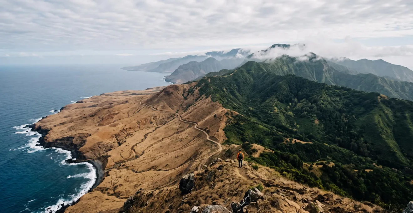
The key to a successful Canary Islands trip isn’t picking one island, but mastering the logistical physics of hopping between them to maximize variety without burnout.
- Efficient travel relies on understanding ferry vs. flight trade-offs, including the critical resident discount that alters flight prices.
- Strategic itinerary architecture involves sequencing islands by geography (vertical West vs. horizontal East) and leveraging microclimates for daily variety.
Recommendation: Shift your mindset from a tourist to an itinerary architect. Use the principles of timing, geography, and climate to design a multi-island route that feels seamless and endlessly diverse.
For adventure-minded travelers, the Canary Islands present a tantalizing paradox. Seven unique islands, each a world unto itself, lie within easy reach. Yet, most visitors chain themselves to a single destination, experiencing just a fraction of the archipelago’s incredible diversity. The common approach is to pick an island based on a simple reputation—Tenerife for hiking, Fuerteventura for beaches—and stay put. This isn’t just a missed opportunity; it’s a fundamental misunderstanding of what makes this volcanic chain so special.
The true art of a Canarian journey lies in movement. But successful island hopping is not about frantic, box-ticking travel. It’s a matter of strategic design, an understanding of what I call the archipelago’s “logistical physics.” This is the interplay of ferry schedules, microclimates, altitude, and geography. Mastering these elements transforms a potentially exhausting trip into a seamless and varied adventure. It’s the difference between seeing a list of places and experiencing a curated story that unfolds across several islands.
But if the secret isn’t just booking more ferry tickets, what is it? The key is to think like a travel designer, not a tourist. It’s about understanding that a mid-day ferry can cost you an entire day of exploration, or that a 30-minute drive on Tenerife can transport you between two completely different ecosystems. This guide is built on that strategic foundation. We will deconstruct the logistical challenges and opportunities of island hopping, from planning efficient ferry routes to leveraging the islands’ unique geographical and climatic diversity to your advantage. We’ll explore why the western islands offer a different kind of adventure than the eastern ones, and how a single day on one island can contain more variety than entire countries.
This guide provides the framework for you to become the architect of your own perfect, multi-island itinerary. Let’s explore the key strategic pillars that will unlock the full 100% of the Canaries’ diversity, far beyond the confines of a single coastline.
Table of Contents: Architecting Your Multi-Island Canary Adventure
- Why Each Island Evolved Distinct Microclimates Despite 100km Proximity
- How to Plan Efficient Inter-Island Ferry Routes in a 10-Day Window
- Eastern Islands vs Western Islands: Which Geography Suits Adventure Seekers?
- When to Book Inter-Island Flights for Lowest Fares and Best Availability
- The Ferry Timing Mistake That Wastes 2 Full Days of Island Time
- Why Altitude and Ocean Exposure Create 6 Distinct Climate Zones in 50km
- How to Design Circular Routes Covering 5 Distinct Landscapes Daily
- Why Tenerife Contains More Ecosystem Types Than Entire European Countries
Why Each Island Evolved Distinct Microclimates Despite 100km Proximity
The first rule of Canarian itinerary architecture is to understand that “island weather” is a myth. Each island is a continent in miniature, a concept driven by the powerful interplay between volcanic topography and the steady northeast trade winds. These winds carry moisture from the Atlantic, but as they hit the steep northern slopes of the taller islands like Tenerife and Gran Canaria, the moist air is forced upwards and cools, forming clouds and bringing rain. This creates lush, green landscapes. The same mountains that trap this moisture then create a “rain shadow” to the south, resulting in arid, sun-drenched coastlines just a few kilometers away.
This phenomenon creates dramatic contrasts. For instance, in San Cristobal de La Laguna on Tenerife, the average temperature can be a cool 13.5°C in winter, while the coastal capital of Santa Cruz, a short drive away, remains much warmer and drier. This isn’t a subtle variation; it’s a complete change of environment. On Gran Canaria, the north is characterized by these cool, moist conditions, while the south, home to Maspalomas and Playa del Inglés, boasts a consistently warm and sunny microclimate that makes it a tourist magnet. Understanding this allows you to plan a day that includes a misty forest hike in the morning and a sunbathing session on desert dunes in the afternoon—on the same small island.
This principle of microclimate stacking is a powerful tool for the savvy traveler. It means you are never truly “rained out” in the Canaries; you just need to drive to a different zone. For an adventure-minded group, it means you can pack multiple distinct experiences into a single day, leveraging the island’s natural divisions to build a dynamic and weather-proof itinerary. The key is to stop thinking of each island as a single entity and start seeing it as a collection of diverse climate zones to be explored.
How to Plan Efficient Inter-Island Ferry Routes in a 10-Day Window
With approximately 123 sailings departing daily across the archipelago, the challenge of island hopping isn’t a lack of connections, but a surplus of choices. An inefficient route can lead to wasted time in ports and on seas, eating into valuable island time. The first strategic decision in your itinerary architecture is choosing your travel model: “Hub-and-Spoke” or “Sequential Hopping.” The hub-and-spoke model is ideal for those who prefer stability; you base yourself on a central, well-connected island like Tenerife or Gran Canaria and take day trips to nearby islands like La Gomera. This minimizes packing and unpacking but limits your exploration to the ferry schedule’s constraints.
For those seeking maximum variety within a 7-14 day window, the sequential hopping model is superior. This involves a linear or circular route, moving from one island to the next with your luggage. This requires more logistical planning but allows for deeper immersion in each location. A common and efficient sequential route connects the eastern islands (Lanzarote → Fuerteventura → Gran Canaria) or the western cluster (Tenerife → La Gomera → La Palma → El Hierro). Mixing the two clusters often requires a flight and is less efficient for shorter trips. Remember to factor in ground transport: having a rental car is crucial for getting to and from ferry ports and exploring the islands, so plan for one-way rentals or routes that allow you to take the car on the ferry.
To make informed decisions, you must analyze not just the destinations but the routes themselves. Frequency, duration, and cost are the three key variables. The table below illustrates the significant differences between popular routes.
| Route | Frequency | Duration | Indicative Fare |
|---|---|---|---|
| Gran Canaria (Las Palmas) → Fuerteventura (Morro Jable) | 5-6 daily | 2 hours | Varies by operator |
| Tenerife (Santa Cruz/Agaete) ↔ Gran Canaria | Over 15 daily | 2-3 hours (Las Palmas) / 80 minutes (Agaete) | €48–€72 |
| Los Cristianos (Tenerife) → Valverde (El Hierro) | 6-7 days/week | 2.5 hours | €54 |
| Santa Cruz (Tenerife) → Fuerteventura | 1-2 daily | 7-8 hours | Varies by operator |
As the table shows, the connection between Tenerife and Gran Canaria is a high-frequency, high-speed corridor, making it an easy hop. In contrast, the longer routes are less frequent and consume a significant portion of a day. This data is the foundation of your geographic sequencing, allowing you to build a logical path that minimizes time at sea and maximizes time on land.
Eastern Islands vs Western Islands: Which Geography Suits Adventure Seekers?
A common mistake is treating all Canary Islands as interchangeable volcanic landscapes. From a strategic adventure planning perspective, the archipelago is best divided into two distinct geographical personalities: the older, more eroded “horizontal” landscapes of the eastern islands (Lanzarote, Fuerteventura) and the younger, dramatically mountainous “vertical” landscapes of the western and central islands (Tenerife, La Palma, La Gomera, El Hierro, Gran Canaria).
The eastern islands are characterized by vast, arid plains, sweeping sand dunes, and relatively low-lying volcanic cones. Here, adventure is horizontal: think windsurfing and kitesurfing along Fuerteventura’s endless beaches, exploring Lanzarote’s otherworldly lava fields on foot or by camel, or cycling across expansive, open landscapes. The adventure is defined by wind, water, and wide-open spaces. The infrastructure supports this, with surf schools and rental shops dotting the coastlines.
Conversely, the western islands offer vertical adventure. Their geography is dominated by massive calderas and towering volcanic peaks, like Mount Teide on Tenerife. The adventure here is about altitude, ascents, and descents. The infrastructure is built around a vast network of signposted hiking trails that traverse cloud forests, deep gorges (barrancos), and volcanic craters. For example, Teide National Park, which covers a massive 18,990 hectares, is the backbone of Tenerife’s hiking network. Similarly, Anaga Rural Park on Tenerife’s northeast tip saw its trail system and facilities improved to handle growing visitor numbers, demonstrating a clear investment in guided, terrestrial adventure. Choosing between east and west is the first step in aligning your itinerary with your group’s adventure style: do you want the thrill of catching wind in a sail, or the reward of a view from a hard-earned summit?
When to Book Inter-Island Flights for Lowest Fares and Best Availability
While ferries are the romantic choice, sometimes flights are a logistical necessity, especially for connecting the eastern and western island clusters or reaching the smaller islands on a tight schedule. However, navigating the pricing on local carriers like Binter Canarias can be confusing for non-residents. The single most important factor to understand is the resident discount. Accredited Canary Islands residents receive a 75% discount on inter-island flights. This has a dramatic effect on the prices you see online.
The initial fare displayed on a booking website is often the heavily discounted resident price. Only after you specify that you are a non-resident does the price jump, often tripling or quadrupling. This isn’t a bait-and-switch; it’s just how the system is designed. Understanding this dynamic from the start prevents sticker shock and allows for realistic budgeting. For a non-resident, booking well in advance is key, as is traveling outside of peak commuter times.
The pricing difference is stark and fundamentally changes the cost-benefit analysis of flying versus taking a ferry. This table shows a typical booking journey for a non-resident.
| Booking Stage | Resident Fare | Non-Resident Fare |
|---|---|---|
| Initial displayed price | €9–€20 | Same price shown initially |
| After selecting traveler type | Unchanged | Price increases roughly 3-4 times |
While the base fares are higher for visitors, strategic booking can still yield reasonable prices. Avoiding Friday and Sunday evenings, when local commuters travel between islands, is the single best tactic. Being flexible with your travel days and comparing fares across a full week can unlock significant savings. For certain demographics, small additional discounts may also be available, but the resident subsidy remains the primary driver of price differences.
Action Plan: Securing Lower Inter-Island Airfares
- Identify Peak Windows: Scrutinize flight schedules and recognize that Friday and Sunday evenings are peak commuter times. Plan to fly mid-week or mid-day to avoid these pricier slots.
- Select Traveler Type Early: When booking, always declare your non-resident status at the first opportunity to see the true fare and avoid wasting time with deceptively low prices.
- Check for Other Discounts: Before finalizing, investigate if you qualify for any other demographic-based reductions, such as those for travelers under 29 or over 60, as these can offer modest savings.
- Book Directly: Always use the official airline website (like Binter Canarias) for bookings, especially if any member of your party could be eligible for a discount, as third-party sites may not handle these correctly.
- Compare Full-Week Fares: Use a flexible date search tool to compare prices across an entire week. A shift of just one day can often result in a significantly lower fare, optimizing your travel budget.
The Ferry Timing Mistake That Wastes 2 Full Days of Island Time
The most common and costly error in island-hopping logistics is a failure to properly value “island time.” Many travelers book a mid-day ferry, thinking it offers a relaxed start to the day. In reality, this is a strategic blunder that can effectively delete a full day of exploration from your itinerary. A 1:00 PM ferry doesn’t just cost you the 2-3 hours of sailing time; it consumes the entire day. The morning is spent packing and checking out, traveling to the port, and waiting to board. The afternoon is spent sailing, disembarking, collecting a new rental car, and finding your new accommodation. By the time you’re settled, the day is gone.
This mistake, repeated twice in a 10-day trip, can cost you two full days of potential adventure. The antidote is the principle of Time Arbitrage: always take the first ferry out in the morning or the last ferry back in the evening. An early morning departure (e.g., 7:00 AM) means you arrive on the new island with the entire day ahead of you. A late evening departure allows you to enjoy a full day of activities before traveling. This discipline is especially critical on routes with limited service. For example, with only up to two ferries per day on some routes to El Hierro, missing a departure or choosing the wrong one has severe consequences for your schedule.
Even with perfect planning, disruptions happen. Ferry delays or cancellations are a real possibility. The savvy itinerary architect builds in resilience. First-hand accounts from seasoned island-hoppers confirm that while the ferry system is generally efficient, having a flexible plan is key. This means never scheduling a high-stakes, pre-booked activity on a travel day. Instead, schedule a low-key, flexible activity like exploring the arrival town or relaxing on a nearby beach. This buffer absorbs any travel delays without derailing your entire plan and causing stress. Having trip cancellation insurance is also a non-negotiable layer of protection for any multi-leg journey.
Why Altitude and Ocean Exposure Create 6 Distinct Climate Zones in 50km
Nowhere is the principle of microclimate stacking more potent than on Tenerife. The island’s dramatic verticality, rising from sea level to the 3,718-meter summit of Mount Teide, creates a compressed journey through multiple climate zones. The temperature drops by roughly 1°C for every 100 meters you ascend. This vertical temperature gradient, combined with the northern trade winds, results in an astonishing six distinct vegetative tiers on the island’s slopes, all within a 50km radius.
You can start your day on a sun-drenched southern beach (subtropical dry), drive up through a belt of hardy succulents and then into a lush subtropical moist zone. Continue climbing and you’ll enter the famous “mar de nubes” or “sea of clouds” (between 500m and 1,500m), a layer of moisture trapped against the mountainside that nourishes the dense laurel and pine forests. Above this cloud layer, you emerge into a completely different world: the high-altitude desert of Teide National Park. Here, the air is dry, the sun is intense, and the landscape is a stark, breathtaking expanse of volcanic rock and endemic high-altitude flora. This zone enjoys an incredible amount of sunshine, making it one of the world’s premier locations for astronomical observatories.
This natural stratification is an adventure playground. For stargazers, it offers an unparalleled experience. By driving up through the clouds in the late afternoon, you can witness the sun set over a vast blanket of white from a viewpoint in the National Park. As darkness falls, the lack of light pollution at this altitude reveals a spectacular celestial display.
- Target Teide National Park after sunset: The park’s high altitude and clear, dry air create some of the best stargazing conditions in the northern hemisphere.
- Find the right viewpoint: The Mirador de Llano de Ucanca and the Portillo area are excellent spots for amateur astronomy, with easy access and wide-open views.
- Plan your timing: Ascend in the late afternoon to see the “sea of clouds” form below you, then stay for the stars to emerge in the pristine night sky.
- Dress in layers: The temperature drops significantly as you ascend, so bring warm clothing that you can remove as you drive back down through the climate zones.
How to Design Circular Routes Covering 5 Distinct Landscapes Daily
For the ultimate expression of microclimate stacking, the Tenerife “Circular Route” is a masterclass in itinerary architecture. This strategy involves using a rental car to circumnavigate the island over one or more days, intentionally traversing its distinct landscape quadrants to experience a compressed but profound sense of its diversity. Instead of basing yourself in one spot and doing out-and-back trips, this approach creates a narrative journey through wildly different ecosystems.
The island can be logically divided into four main quadrants for this purpose, allowing you to design a loop that showcases its full spectrum:
- Northeast (Anaga): Start in the ancient, 7-million-year-old Anaga massif. This UNESCO Biosphere Reserve is a labyrinth of sharp peaks and deep ravines covered in dense, primeval laurel forest.
- Northwest (Teno): Move west to the Teno massif, another rugged and geologically old part of the island, famous for the dramatic Masca gorge and its picturesque, isolated villages.
- Central (Teide): From either the north or south, all roads lead up to the heart of the island: the high-altitude volcanic desert of Teide National Park. This forms the central hub of any circular route.
- South (Arid Coast): Complete the loop by descending to the southern coast. The landscape transforms into an arid, sun-baked environment with famous beaches and resort towns, offering a stark contrast to the lush forests of the north.
A truly advanced strategy involves not just driving this loop, but breaking it up with overnight stays in different quadrants. For example, pairing a stay in Vilaflor, Spain’s highest municipality at 1,400 meters on the edge of the pine forest, with a subsequent stay in a village like Taganana, nestled in a steep valley leading to a black-sand beach in Anaga. This “multi-basing” strategy naturally creates a circular, multi-landscape journey, minimizing daily drive times and maximizing immersion in each unique environment. It transforms the island from a single destination into a chain of interconnected, diverse experiences, allowing you to witness five or more distinct landscapes in a single, well-planned day of travel.
Key Takeaways
- Island hopping success is measured by logistical efficiency, not just the number of islands visited; mastering this is key.
- The Canary Islands are divided into “vertical adventure” western islands (hiking, altitude) and “horizontal adventure” eastern islands (watersports, open plains).
- Strategic timing, such as taking the first or last ferry of the day, is crucial for maximizing usable “island time” and avoiding wasted travel days.
Why Tenerife Contains More Ecosystem Types Than Entire European Countries
The true scale of the Canary Islands’ diversity, particularly on an island like Tenerife, can be difficult to comprehend. The claim that it holds more ecosystem types than some entire European countries might sound like hyperbole, but it’s a conclusion rooted in ecological fact. The island’s combination of extreme vertical relief, multiple climatic influences, and geological isolation has created a concentration of biodiversity that is globally significant. The Anaga massif is a prime example of this phenomenon.
In 2015, UNESCO declared a vast area of the Anaga massif a Biosphere Reserve, spanning over 48,727.61 hectares of land and sea. This designation isn’t merely honorary; it recognizes a unique concentration of natural and cultural value. The power of this biodiversity is not just in its beauty but in its density. Within this single massif, you find a mosaic of protected areas, each with a different legal status and ecological focus, demonstrating a complexity that is staggering for such a small land area.
This is the ultimate justification for a strategic, multi-island approach. By visiting only one beach or one resort town, you are missing the profound ecological story told by the archipelago’s varied landscapes. To experience the ancient laurel forests, the high-altitude volcanic deserts, the wind-swept dunes, and the lush northern valleys is to understand the true meaning of the Hesperides. This level of planning is not just about logistics; it’s about unlocking access to a world-class ecological treasure, a living museum of evolution and adaptation that few other places on Earth can offer in such a compact and accessible form.
Macizo de Anaga hosts significant faunal diversity, with reptiles, birds and fish, and in particular large numbers of invertebrates, with 1,900 species recorded. The reserve consists of four protected natural areas, a Rural Park and three Integral Natural Reserves, as well as areas that form part of the Natura 2000 network, including a Special Bird Protection Area and Special Areas of Conservation.
Now that you are equipped with the strategic framework of a travel designer, the next step is to begin sketching out your own itinerary architecture. Start by choosing your adventure style—vertical or horizontal—and build a route that embraces the principles of time arbitrage and microclimate stacking to create an unforgettable, variety-rich journey through the archipelago.