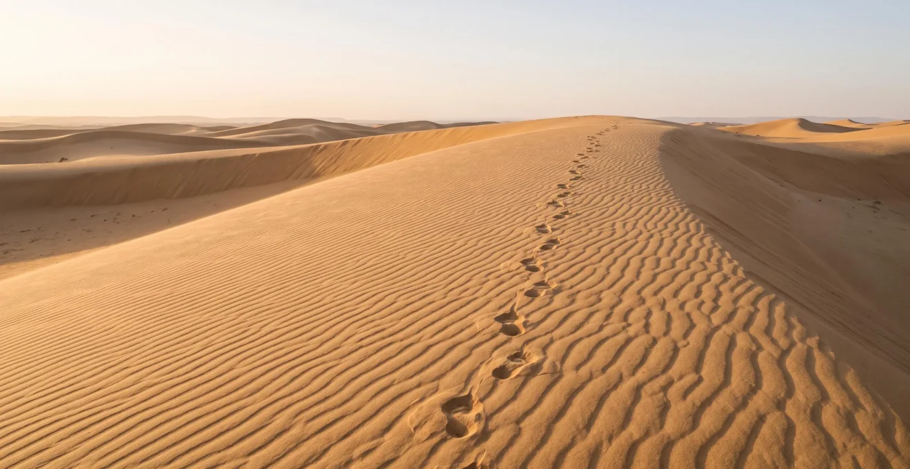
Achieving truly powerful images of the Maspalomas dunes requires more than good light; it demands a photographer’s commitment to ecological stewardship.
- The dunes are a fragile, shifting system with a dual Saharan-marine origin, highly vulnerable to human impact.
- Access is strictly limited to marked paths to prevent erosion and protect delicate, specialised vegetation.
Recommendation: Use the official trails and telephoto lenses creatively to frame pristine, untouched landscapes, turning conservation rules into a compositional advantage.
For any landscape photographer, the Maspalomas dunes present an irresistible canvas: a sea of golden sand sculpted by wind, promising images of pristine, abstract beauty. The common advice focuses on capturing the golden hour or protecting your gear from sand. But these tips miss the most critical element of photographing this unique environment. The real art lies not just in what you capture, but in what you protect while doing so. This landscape is not a static backdrop; it’s a living, breathing, and incredibly fragile ecosystem under immense pressure.
The temptation to step off the path for that “perfect, untrodden” angle is strong, yet it’s a profound misunderstanding of the landscape’s character. The very footprints left behind unravel the delicate ecological balance, accelerating erosion and scarring the natural canvas you came to admire. The most compelling dune photography, therefore, comes from a place of understanding and respect. It’s about creative stewardship—transforming the perceived limitations of conservation rules into powerful compositional tools.
This guide moves beyond the basics of light and composition. We will explore the geological story of the sand, the precise methods for legal and ethical access, and the techniques to capture its dramatic textures without leaving a single trace. By understanding the “why” behind the rules, you will not only become a more responsible visitor but a more effective visual storyteller, creating images that convey the true, wild essence of this protected territory.
This article provides a comprehensive framework for photographers committed to both their craft and conservation. The following sections detail everything from the dunes’ origins to the legal protections that ensure their survival.
Summary: A Photographer’s Guide to the Maspalomas Protected Landscape
- Why Saharan Sand Travelled 400km Across Ocean to Form Island Dunes
- How to Access Maspalomas Dunes Using Authorised Entry Points Only
- Morning Golden Light vs Sunset Shadows: Which Reveals Dune Contours Best?
- When Wind Patterns Create the Most Dramatic Dune Ridges Throughout the Year
- The Photography Positioning Error That Damages Protected Vegetation Borders
- How to Photograph Volcanic Landscapes Without Losing Dramatic Texture
- Why UNESCO and EU Designations Layer Multiple Protection Levels
- Why 45% of Island Territory Holds Protected Status Under Spanish Law
Why Saharan Sand Travelled 400km Across Ocean to Form Island Dunes
To truly photograph the Maspalomas dunes is to understand the incredible journey of each grain of sand. This is not simply a pile of sand; it’s a dynamic sedimentary system with a complex history. Research confirms that the sand forming these dunes has a documented dual marine-Saharan origin. Part of it is composed of pulverised marine life—tiny fragments of shells and calcareous algae ground down by the ocean over millennia. The other part is comprised of fine quartz and mineral dust that has completed an epic 400km journey across the Atlantic Ocean, carried from the Sahara Desert by the wind.
This dual identity is what gives the dunes their unique colour and texture, a story waiting to be told through macro photography. Capturing the subtle variations in the grains—the pale, almost white tones of the marine remnants mixed with the warmer, golden hues of the Saharan minerals—adds a layer of narrative depth to your images. This is more than just a landscape; it’s a geological archive. However, studies into the area’s sediment transport have identified a significant sediment shortage, making the existing dunes an even more precious, non-renewable resource. Every footprint disrupts this delicate balance, contributing to the net loss of this well-travelled sand.
How to Access Maspalomas Dunes Using Authorised Entry Points Only
The allure of an empty, rolling dune is powerful, but accessing it requires strict adherence to conservation rules. Free-roaming across the dunes is illegal and highly destructive. The authorities, understanding the need for both preservation and enjoyment, have established a clear and accessible network of trails. Under the Masdunas conservation project, a significant effort was made to formalise access, resulting in 8 kilometres of marked paths rehabilitated to guide visitors through the reserve without causing harm.
For photographers, these paths are your tripod locations, your vantage points, and your compositional guides. The primary and most informative way to enter the reserve is via the main information centre. Following this route ensures you are correctly oriented and aware of the most current regulations.
- Start at the Information Centre: Begin your visit at the main centre located at Playa del Inglés. Here you can get maps and essential conservation guidance before you enter the fragile environment.
- Follow the Main Trail: The officially marked path, often referred to as ‘branch number 3’, is your designated route into the heart of the different dune zones.
- Stay on the Path: As you walk, you will pass through various ecosystems within the reserve. The marked posts and bollards are not suggestions; they are mandatory boundaries designed to protect the landscape.
- Reach the Coast: The trail culminates at the expansive Maspalomas Beach. From here, you can also explore the adjacent Maspalomas Pond (La Charca) and its unique Palmeral (palm grove), which offer different photographic subjects.
Critically, access to the dunes via these official routes remains completely free of charge. The system is designed to encourage responsible tourism, not to restrict it. Viewing the marked paths as a creative constraint, rather than a limitation, is the key to successful photography here.
Morning Golden Light vs Sunset Shadows: Which Reveals Dune Contours Best?
The debate between sunrise and sunset is a classic among landscape photographers. In Maspalomas, however, the choice has practical and ethical dimensions that go beyond aesthetics. While both times offer the low-angled light that carves out dramatic shadows and reveals texture, the morning holds a distinct advantage. The primary reason is the condition of the sand itself. Overnight, the constant trade winds work to erase the day’s footprints, smoothing the surfaces and restoring the pristine, natural patterns of the dunes. Arriving at dawn means you are greeted by a cleaner, more authentic canvas.
Furthermore, practical conditions are far more favourable. The early morning conditions of 18-22°C offer the cleanest, most photogenic dune surfaces, with cool sand underfoot and typically calmer winds. By sunset, the dunes have endured thousands of visitors, and even areas far from the paths show signs of disturbance. As one experienced travel photographer noted, the purity of the scene is paramount:
The absence of footprints is more important for taking good photos than the presence of strong shadow lines from a low sun.
– Travel photographer, Travelinmypocket.com
Shooting at dawn aligns perfectly with the conservationist mindset. It allows you to capture the dunes in their most undisturbed state, rewarding the effort of an early start with images that feel truly wild and untouched. The low sun angle will still provide the desired three-dimensional shaping, but on a surface that hasn’t been compromised by the day’s foot traffic. This is the secret to capturing the textural integrity of the landscape.
When Wind Patterns Create the Most Dramatic Dune Ridges Throughout the Year
The Maspalomas dunes are not a static monument; they are a living entity, constantly reshaped by the wind. This perpetual motion is what creates the sharp, elegant ridges and sweeping curves that photographers seek. The trade winds, particularly the Calima wind carrying Saharan dust, are the primary sculptors. This constant action is quantifiable; studies show that the blowing wind constantly reshapes the dunes, moving them 2-5 metres annually in a westward direction. This means the landscape is never the same twice, offering endless new compositions.
The most dramatic ridges, known as “crestas,” are often formed after periods of sustained, consistent wind. While this can happen at any time of year, photographers should pay attention to the weather forecast leading up to their shoot. A few days of steady wind from the same direction will build up the sharpest, most defined lines. Conversely, turbulent or multi-directional winds can create softer, more chaotic patterns.
Case Study: The Post-Lockdown Restoration
The power of the wind to restore the dunes was dramatically illustrated during the island-wide lockdowns. With a sharp drop in visitor numbers for nearly two years, researchers observed a clear and rapid improvement in the dunes’ surface condition. The wind had the time and space to erase widespread human impact, restoring natural formations. This observation directly led authorities to reinforce conservation efforts, restricting walking to the rehabilitated 8-kilometre trail system to preserve this natural regenerative process.
For a photographer, this means the best time to shoot is not tied to a specific month, but rather to recent weather patterns and the absence of human interference. By working with the wind’s natural artistry—and respecting the boundaries that allow it to perform its work uninterrupted—you can capture the most dynamic and sculptural forms of the dunes.
The Photography Positioning Error That Damages Protected Vegetation Borders
One of the most critical and often overlooked aspects of the Maspalomas reserve is the vegetation. The sparse, hardy plants that dot the edges of the dunes and stabilise certain areas are not weeds; they are highly specialised species that form the backbone of the ecosystem. The most common and damaging positioning error photographers make is stepping into these vegetated zones to get a “cleaner” shot of the sand. This act, known as trampling, is devastating to the fragile plant life and destabilises the sand, accelerating erosion.
The rules are unambiguous: all access is limited to paths marked with posts and bollards. “Free-roaming” is punishable by law. Your creative challenge is to work within these boundaries. The solution is not to get physically closer, but to use your equipment intelligently. A telephoto lens becomes your most important conservation tool. It allows you to stand on a designated path and isolate distant, pristine dune ridges, compressing the perspective and cropping out any distracting foreground elements. This technique turns the pathway from a restriction into a strategic vantage point, enabling you to capture the wildness of the dunes without harming them.
Before every shoot, an ethical positioning audit is essential. This mental checklist ensures your creative process actively supports the conservation of the very landscape you are there to celebrate.
Your Pre-Shoot Positioning Checklist: Ethical Framing in the Dunes
- Confirm Your Position: Are both of your feet and all of your equipment (tripod, bag) fully on a path marked with posts or bollards?
- Scan the Borders: Identify the nearest vegetation line. Is there any risk of your movement or equipment disturbing the plants or the sand around their root systems?
- Assess Your Focal Length: Is the composition you want achievable from your current legal position by changing your lens or focal length? Prioritise zooming with your lens over “zooming with your feet.”
- Check for “Social Trails”: Avoid using unofficial, faint paths created by others. These are evidence of past rule-breaking and contribute to cumulative damage. Stick only to clearly marked routes.
- Plan Your Exit: Ensure your path back out of the reserve is as respectful as your entry, especially as light fades and boundaries become less clear.
How to Photograph Volcanic Landscapes Without Losing Dramatic Texture
While the dunes are the main attraction, their golden sands are set against a backdrop of dramatic, dark volcanic rock. This contrast is a core part of Gran Canaria’s visual identity. To ignore it is to miss half the story. The island’s deep, textured landscapes are a direct result of its turbulent geological past. Understanding that Gran Canaria’s 14.5-million-year volcanic history explains its dramatically textured rock landscapes provides the context needed to photograph them effectively. It’s a history of violent construction and gradual erosion, leaving behind a legacy of jagged cliffs, solidified lava flows, and stark, imposing mountains.
The primary challenge when photographing these dark volcanic features, especially next to bright sand or sea, is managing the dynamic range. Your camera’s sensor can struggle to capture detail in both the deep shadows of the rock and the bright highlights of the sand simultaneously. The key is to avoid letting the rocks become uniform black silhouettes. Instead, focus on capturing their raw, complex texture.
To do this, shoot when the light is at a low, raking angle—early morning or late afternoon. This low light catches the countless small edges and cracks in the rock, creating micro-shadows that reveal its three-dimensional character. A polarising filter can also be invaluable, as it cuts down on glare from the rock’s surface, deepening its colour and enhancing its visible texture. Tamadaba Natural Park, which stretches from volcanic peaks to a rugged coastline, is an excellent location to practice these techniques. Accessible viewpoints like El Balcón allow photographers to capture the dramatic meeting of volcanic cliffs and the ocean from safe, designated areas.
Key Takeaways
- Respect the Paths: Your greatest creative tool is constraint. Use the official marked trails as your exclusive vantage points to protect the fragile ecosystem.
- Embrace the Telephoto Lens: Instead of getting closer, use a longer focal length to isolate pristine, distant dunes and create powerful, compressed compositions.
- Prioritise Morning Light: Shoot at dawn to capture the dunes in their cleanest, most naturally sculpted state, free from the day’s foot traffic.
Why UNESCO and EU Designations Layer Multiple Protection Levels
The rules governing the Maspalomas dunes are not arbitrary; they are the local expression of a multi-layered international conservation effort. In 2005, UNESCO declared Gran Canaria a Biosphere Reserve, layering protection over roughly 43% of the island and its surrounding marine area. This designation is not just an honorary title; it’s a framework for balancing human activity with environmental preservation. The Maspalomas Dunes Special Nature Reserve falls squarely within this protected territory.
This UNESCO framework is further reinforced by European Union directives (like the Natura 2000 network) and national Spanish laws. This creates a “nesting doll” of legal protection, where each layer adds a different level of safeguarding and management responsibility. For a photographer, understanding this means recognising that you are working within a site of global ecological significance. The Biosphere Reserve is typically structured into three distinct zones, each with a different function and level of restriction.
| Zone | Function | Included Areas |
|---|---|---|
| Core Zone | Most centralised, strictly protected ‘reserve territory’ | Inagua Integral Nature Reserve, Güi-Güi Special Nature Reserve, Tamadaba Natural Park, Pilancones Natural Park, Risco de Tirajana Natural Monument |
| Buffer Zone | Acts as a protective shield surrounding the core | Nublo Rural Park, Roque Nublo Natural Monument, Tauro Natural Monument, Amurga Site of Community Importance |
| Transition Zone | Bridges protected land with areas outside the reserve | The Protected Landscape of the Summits |
While the Maspalomas dunes have their own specific “Special Nature Reserve” status, they exist within this broader context. The core zones, like Tamadaba, receive the highest level of protection, while buffer and transition zones manage the interplay between conservation and sustainable human use, including responsible tourism and photography.
Why 45% of Island Territory Holds Protected Status Under Spanish Law
The fact that nearly half of Gran Canaria is legally protected territory speaks volumes about the island’s commitment to preserving its unique natural heritage. This extensive network of parks, reserves, and natural monuments is a conscious policy choice, driven by an understanding that the island’s incredible biodiversity and dramatic landscapes are its most valuable assets. This is not just about the dunes; it encompasses pine forests, volcanic calderas, sheer sea cliffs, and unique habitats found nowhere else on Earth. The entire protected network acts as a single, interconnected system.
For a landscape photographer, this is an extraordinary opportunity. It means that wherever you travel on the island, you are likely to encounter landscapes managed for their long-term health rather than short-term commercial gain. Areas like Tamadaba Natural Park are prime examples, existing as a core protected area within the UNESCO Biosphere Reserve, yet remaining accessible to the public via well-maintained roads and trails. This model demonstrates that protection does not have to mean exclusion. Instead, it means managed, respectful access.
Your role as a photographer within this system is one of a privileged observer. The conservation laws provide you with a landscape kept in a more pristine state, and in return, the expectation is that you will act as a steward. By following the rules—staying on paths, not disturbing wildlife, and leaving no trace—you become an active participant in this island-wide preservation effort. Your images can then become powerful advocacy tools, showcasing the beauty that these protections make possible and inspiring others to visit with the same level of respect.
By adopting this mindset of creative stewardship, your photography in Maspalomas can transcend simple documentation. It becomes a celebration of a fragile, beautiful, and fiercely protected world. Start today by planning your next shoot not just around the light, but around the principles of preservation.