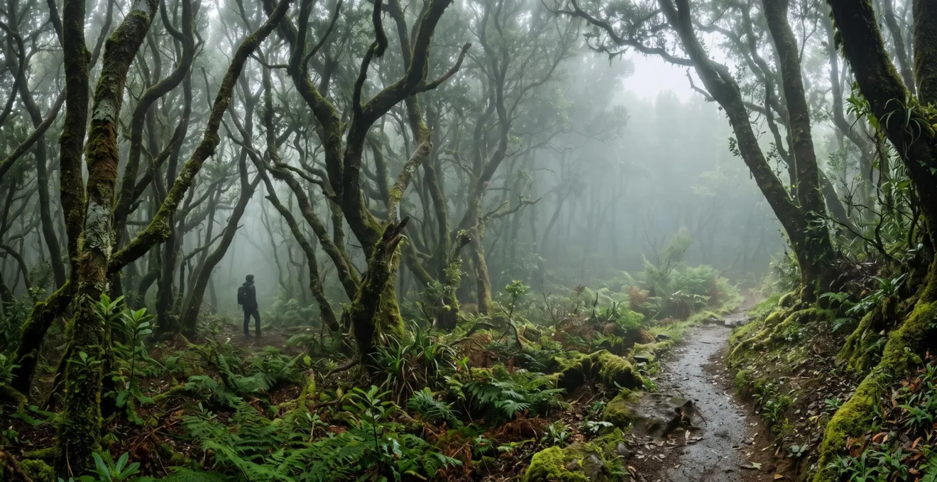
These aren’t just misty forests; they are precise climatic time capsules, preserving an ecosystem Europe lost millions of years ago.
- They survived because oceanic islands acted as stable refuges while continental climates collapsed during the Ice Ages.
- Their uniqueness comes from ancient relict species, not just altitude, making them fundamentally different from other cloud forests.
Recommendation: To truly experience them, learn to identify the key ‘living fossil’ trees and understand the predictable science behind the mist.
Imagine walking through a dense, dripping-wet forest, where every leaf and patch of moss seems to hum with ancient history. For many visitors to the laurel forests of Macaronesia, the experience is purely aesthetic—a “magical” or “enchanting” hike through the clouds. This sensory immersion is profound, but it only scratches the surface of a much deeper story, a narrative written in geologic time that stretches back tens of millions of years. Many guides and articles label these woodlands as a type of “cloud forest” or a “prehistoric” remnant, but these terms fail to capture the staggering precision of their survival.
The real story isn’t just that these forests are old. It’s about *why* they are here and nowhere else. It’s a tale of continental catastrophe and island sanctuary, of climatic chaos and oceanic stability. What if the key to understanding these forests wasn’t in their mist, but in their isolation? What if we approached them not as a simple nature walk, but as a journey into a living evolutionary clock, one that stopped ticking across Europe during the Ice Ages but continued running, undisturbed, on these tiny specks of land in the Atlantic?
This article is your guide to that timeline. We will peel back the layers of mist to reveal the scientific mechanisms that make these forests a planetary treasure. We’ll explore how the Ice Ages acted as a great filter, wiping these ecosystems from the mainland. You’ll learn to identify the “living fossil” trees that form the forest’s backbone, understand what truly separates them from any other cloud forest on Earth, and discover how to witness their most iconic phenomena without the crowds. Finally, we’ll examine why these specific sites earned UNESCO’s highest protection, cementing their status as irreplaceable assets for all humanity.
To navigate this journey through deep time, the following guide breaks down the evolutionary story and practical realities of the laurisilva. Each section unpacks a different chapter, from its ancient origins to the modern challenges of its preservation.
Summary: A Journey Through a Lost European Ecosystem
- Why Ice Ages Eliminated Laurel Forests Everywhere Except Oceanic Islands
- How to Identify Tree Species Unchanged for 20 Million Years
- Laurisilva vs Cloud Forest: What Makes Canarian Woodlands Globally Unique
- How to Experience Forest Mist Without Encountering Tourist Crowds
- The Trail Deviation Mistake That Leads 50% of Hikers Into Restricted Zones
- Why Island Isolation Created Evolutionary Laboratories Producing Unique Species
- Why Only 6 Atlantic Laurel Forests Met UNESCO’s Strict Universality Criteria
- Why UNESCO Designated These Forests Irreplaceable Planetary Assets in 1999
Why Ice Ages Eliminated Laurel Forests Everywhere Except Oceanic Islands
To understand the laurisilva’s survival is to first grasp the scale of its extinction. This is not a forest type that evolved in isolation on islands; it is the last stand of a world that has otherwise vanished. Naturalists have documented that more than 20 million years ago, Laurisilva forests covered a large part of the Mediterranean basin during the Tertiary period. This was the planet’s dominant temperate vegetation, a green blanket stretching across what is now Southern Europe and North Africa, thriving in a warm, stable, and humid climate.
The death knell for this vast ecosystem was the onset of the Quaternary glaciations, roughly 2.6 million years ago. As ice sheets advanced from the poles, the continental climate didn’t just get colder; it became violently unstable and drastically drier. The warm, subtropical conditions the laurel forests depended on were obliterated. The fossil record tells a brutal story of retreat and annihilation. As a study on the ecology of these forests notes, of 17 genera of the Lauraceae family recorded in European fossils, only a single one, Laurus, managed to avoid complete extinction on the continent.
While the mainland froze, the Macaronesian islands—the Canaries, Madeira, Azores—became a climatic refuge. Buffered by the immense thermal stability of the Atlantic Ocean, their climate remained mild and moist, mimicking the lost world of the Tertiary. A fascinating study using phylogenetic dating methods confirms this timeline with genetic precision. It revealed that the large majority of laurel forest taxa on the islands originated in the Plio-Pleistocene, a period that coincides precisely with the mass extinction of continental laurel forests. The islands weren’t just a passive sanctuary; they were the lifeboat where the last genetic blueprints of this ancient ecosystem were actively preserved while the rest of their world disappeared.
Therefore, every step you take in a laurisilva is a step on ground that holds the memory of a biome that once defined a continent.
How to Identify Tree Species Unchanged for 20 Million Years
Walking through the laurisilva is like reading a living history book, but to do so, you must learn its alphabet. The trees themselves are the main characters, direct descendants of the Tertiary blueprint. According to UNESCO’s official justification for their protection, this ecosystem is an outstanding relict of a forest type that dominated Southern Europe 15-40 million years ago. This means the glossy leaf in your hand features an engineering solution for capturing moisture that has been perfected over an almost unimaginable timescale. Learning to distinguish the key species transforms a walk in a green forest into a palaeobotanical exploration.
While the biodiversity is immense, hikers can quickly learn to spot the “big four” that form the core of the ecosystem. These aren’t just random trees; they are pillars of this relict world.
- Bay Laurel (Laurus novocanariensis): The quintessential species, with the glossy, aromatic leaves familiar to many. Its classic silhouette is a defining feature of the canopy.
- Fetid Laurel or ‘Til’ (Ocotea foetens): A true giant of the forest, often identified by its mossy, gnarled, and ancient-looking trunk. It emits a musty smell when the bark is scratched, a primitive defense mechanism.
- Madeira Mahogany (Persea indica): Recognizable by its broader leaves and the distinct reddish hue of its new, young growth, which contrasts with the deep green of the older canopy.
- Canary Laurel or ‘Barbusano’ (Apollonias barbujana): This tree often forms a dense, dark upper canopy, contributing to the forest’s characteristic deep shade and high humidity.
One of the most elegant features to observe is the “drip-tip” on many laurel leaves. This elongated, pointed tip, as seen in the image above, is a brilliant adaptation. It allows excess water from the constant mist and rain to run off quickly, preventing the growth of fungi and mosses on the leaf surface and ensuring the tree can photosynthesize efficiently. It is a tiny, perfect piece of evolutionary engineering unchanged for millions of years.
By recognizing these living fossils, you are no longer just a tourist but an active reader of the deep-time story written in bark and leaf.
Laurisilva vs Cloud Forest: What Makes Canarian Woodlands Globally Unique
One of the most common misconceptions is to equate “laurisilva” with “cloud forest” as if the terms were interchangeable. While the laurisilva is indeed a forest that is frequently enveloped in clouds, this description misses the fundamental point of its global uniqueness. A cloud forest is a climatic situation: it can be found anywhere in the tropics or subtropics where a mountain slope meets persistent cloud cover. A laurisilva, however, is an evolutionary lineage—a specific assembly of relict species descended from the ancient Tertiary forests of Europe.
This distinction is critical. The species in a cloud forest in Costa Rica or Southeast Asia assembled independently and have no direct historical connection to the laurisilva of Macaronesia. The latter is a time capsule, a fragment of a specific lost world. This is proven by the staggering level of endemism—species that exist here and nowhere else on Earth. While many cloud forests are biodiverse, the laurisilva functions as a true evolutionary laboratory. For instance, in Garajonay National Park, UNESCO notes that it is thought that between 40-60% of the invertebrate fauna is endemic. This level of species exclusivity is a direct result of millions of years of uninterrupted evolution in isolation.
The following table clarifies the key differences between the specific, relict-based laurisilva and a generic, climate-based cloud forest.
| Feature | Laurisilva (Canarian/Macaronesian) | Generic Cloud Forest |
|---|---|---|
| Defining Factor | Ancient relict species composition (a specific evolutionary lineage) | Altitude and persistent mist (a climatic situation) |
| Geographic Exclusivity | Found only in Macaronesia (Canaries, Madeira, Azores) | Found on tropical mountains worldwide (Andes, Central America, SE Asia) |
| Typical Altitude Band | Roughly 600–1,500 m, where trade-wind mist condenses | Variable, generally wherever persistent cloud cover meets a slope |
| Origin Story | Descended from Tertiary-era vegetation once found across the Mediterranean basin | Species assembled independently in each mountain range, no shared ancient lineage |
So while the laurisilva exists within a cloud, it is not *just* a cloud forest. It is a ghost of a past continent, preserved by the unique alchemy of oceanic climate and island isolation.
How to Experience Forest Mist Without Encountering Tourist Crowds
The iconic image of the laurisilva is the “mar de nubes,” or sea of clouds—a vast, white blanket of mist filling the valleys, with forested ridges piercing through like dark islands. This isn’t a random, unpredictable weather event; it’s a highly reliable meteorological phenomenon driven by the trade winds. Understanding its science is the key to experiencing it in solitude, far from the crowded viewpoints. The magic has a mechanism: moist air from the Atlantic is pushed against the islands’ northern slopes and forced to rise, where it cools and condenses into a thick layer of stratocumulus clouds.
This phenomenon is predictable because this horizontal mass of clouds forms naturally at altitudes of 500 to 1,500 m. This is the “sweet spot” where the forest thrives. For a hiker, this means you can plan your visit to be either *inside* the mist for an atmospheric walk or *above* it for the spectacular sea-of-clouds view. The key is to time your visit and choose your location wisely. The cloud layer is often most stable and visually impressive in the early morning or late afternoon, when thermal conditions are just right.
To escape the crowds that flock to the most famous, easily accessible “mirador,” the strategy is to aim for elevation and obscurity. Instead of driving to the main viewpoint, select a lesser-known trailhead in the midlands that ascends above the 1,500-meter line. From there, a short hike can take you to a ridge offering the same breathtaking views but without the tour buses. Conversely, to immerse yourself in the mist, choose a trail that stays within the 600-1,200 meter band on a day when the trade winds are active. This scientific approach turns a game of chance into a predictable and deeply rewarding experience.
This transforms you from a passive tourist hoping for good weather into an informed naturalist interacting with the predictable rhythms of the island’s climate engine.
The Trail Deviation Mistake That Leads 50% of Hikers Into Restricted Zones
The very mist that gives the laurisilva its ethereal beauty also presents its greatest danger: disorientation. Within minutes, a clear path can dissolve into a confusing maze of near-identical trees and shifting fog, dramatically reducing visibility. In these conditions, a simple mistake in navigation can have serious consequences. It’s a sobering fact that wandering off-trail is the single leading cause for search and rescue operations involving adult hikers, ahead of both injury and bad weather. The risk is particularly acute for casual visitors; international rescue data consistently shows that day hikers comprised 42 percent of all search and rescue cases in national parks, nearly four times the next group.
The most common error is mistaking a “false trail” for the official path. These can be drainage channels, animal tracks, or shortcuts created by previous hikers that look deceptively like the main route. In the low, diffused light of the forest, these paths can be very convincing. A moment of inattention at a trail junction is all it takes. As survival instructor Andrew Herrington notes, this is the number one reason people get lost. The key to safety is not superior fitness or gear, but disciplined navigation and a healthy skepticism of any unmarked path.
Before entering the forest, especially on a misty day, it is essential to be prepared. The dense canopy and topography can easily block mobile signals, rendering online maps useless. Having a reliable offline map and knowing how to use it is the most critical piece of safety equipment you can carry.
Action Plan: How to Avoid False Trails in the Laurel Forest
- Recognize the Decision Point: Be extra vigilant at any trail junction or fork. This is the psychological point where confidence often overtakes caution and mistakes are made.
- Verify Maintenance Signs: Never trust a trodden path alone. Look for official signs of a maintained trail, such as stone edging, wooden steps, or official waymarkers, before committing to a fork.
- Trust Your Map, Not Your Instincts: If a path deviates from what your offline map shows, the map is almost certainly correct. The dense forest can play tricks on your sense of direction.
- Download Offline Maps: Before you lose signal, download the trail map for your route onto your phone using a reliable hiking app. Treat this as non-negotiable.
- Turn Back at First Doubt: The moment you feel uncertain you are on the correct trail, stop and backtrack to your last known point. Pushing forward when lost is the most common and dangerous mistake.
Proper preparation ensures your journey through this ancient world is memorable for its beauty, not for a rescue operation.
Why Island Isolation Created Evolutionary Laboratories Producing Unique Species
If the Ice Ages turned mainland Europe into an ecological desert for laurel forests, the Macaronesian islands became the opposite: a vibrant evolutionary laboratory. Isolation is one of the most powerful engines of evolution. When a small population becomes geographically cut off, it begins to follow its own unique evolutionary path, adapting to the specific pressures and opportunities of its new environment. Over millions of years, this process of “speciation” can lead to the emergence of life forms found nowhere else on the planet.
The laurisilva is a living showcase of this principle. The sheer numbers are staggering. On the island of La Gomera, home to Garajonay National Park, a detailed biodiversity assessment found that of the fauna recorded, 343 species are endemic to the Canary Islands, meaning they evolved there and exist nowhere else. This isn’t just a handful of unique plants; it’s an entire, intricately woven web of life that is exclusive to this tiny corner of the world. This is the true treasure of the laurisilva.
A classic example of this process can be seen in the forest’s birdlife. As UNESCO highlights, two relict species, the White-tailed Laurel Pigeon and the Dark-tailed Laurel Pigeon, are endemic to the Canaries. Genetic evidence suggests they diverged from a common ancestor. Over time, one adapted to the dense inner forest canopy, while the other specialized in foraging near the rocky cliff edges at the forest’s periphery. They are two different solutions to the puzzle of survival, born from the same ancestral stock, a perfect illustration of adaptive radiation in action. Every rustle in the undergrowth or birdsong from the canopy could be from a creature whose entire evolutionary story is contained within the confines of these islands.
It transforms the forest from a collection of trees into a dynamic theater of life’s creativity, a place where you can witness the processes that Darwin first observed in the Galápagos.
Why Only 6 Atlantic Laurel Forests Met UNESCO’s Strict Universality Criteria
While fragments of laurel-type forest exist across the Macaronesian archipelagos, not all are created equal. The UNESCO World Heritage designation is reserved for sites of “Outstanding Universal Value,” a benchmark that is exceptionally difficult to meet. Of all the remnants, only a handful have been inscribed on the prestigious list, including Garajonay in La Gomera and the Laurisilva of Madeira. The primary reasons these sites were chosen over others come down to two critical factors: scale and intactness.
The Laurisilva of Madeira is the ultimate benchmark in this regard. It is, by a significant margin, the largest surviving area of this relict ecosystem. According to the World Heritage Explorer, the protected area in Madeira covers approximately 15,000 hectares, and is believed to be 90 percent primary forest. “Primary forest” is a crucial term, meaning it has never been clear-felled and retains its original ecological processes, structure, and biodiversity. Many other fragments have been heavily impacted by logging, agriculture, and invasive species, compromising their connection to the ancient Tertiary blueprint.
UNESCO’s justification for inscription hinges on specific criteria. For the laurisilva, the most important is Criterion (ix), which relates to a site being an outstanding example of ongoing ecological and biological evolutionary processes. The official datasheet for Madeira’s inscription states this clearly: “The Laurisilva of Madeira is an outstanding relict of a previously widespread laurel forest type, which covered much of Southern Europe 15-40 million ye[ars ago]”. To meet this criterion, a site must be large enough to be a self-sustaining ecological unit and pristine enough to be a true, unadulterated example of that ancient ecosystem. Only the largest and best-preserved remnants, like those in Madeira and La Gomera, could clear this high bar.
These aren’t just representative samples; they are the crown jewels, the most complete and valuable chapters left of this millions-of-years-old story.
Key Takeaways
- These forests are not just “cloud forests” but relict ecosystems from the Tertiary period, wiped out elsewhere by Ice Ages.
- Their survival is due to the stable, humid climate of oceanic islands, which acted as a “climatic refuge.”
- The high level of unique, endemic species makes them living “evolutionary laboratories,” distinct from any other forest type.
Why UNESCO Designated These Forests Irreplaceable Planetary Assets in 1999
The formal recognition of the laurisilva’s global importance was a landmark moment in conservation history. When UNESCO inscribed the Laurisilva of Madeira as a World Heritage Site in 1999, it was a definitive statement: this was not just a beautiful local forest, but an irreplaceable asset for all of humanity. This designation brought global attention, resources, and a powerful mandate for its protection. For centuries, these forests had been under threat from human impact, including logging for timber and charcoal, and conversion of land for agriculture. As the IUCN notes, the establishment of protected areas like Garajonay National Park was what “prevented the loss of the largest remnant of Laurel forest in the Canary Islands.”
However, a UNESCO designation is not a magic shield that makes all threats disappear. It is the beginning of a perpetual commitment to stewardship, as these ancient ecosystems remain incredibly fragile. The need for this continued vigilance was tragically illustrated by a catastrophic event in one of the protected sites.
Case Study: The 2012 Wildfire That Exposed Garajonay’s Vulnerability
Despite decades of protection under both national park and World Heritage status, a devastating wildfire in 2012 swept through parts of La Gomera, severely impacting the Garajonay National Park. The fire destroyed park infrastructure and, more importantly, burned sections of the ancient forest. While the core, most humid areas of the laurisilva are naturally resistant to fire, the blaze demonstrated that even these wet forests are not immune, especially at their drier edges and during periods of extreme drought. The incident served as a stark reminder that threats like climate change and increased fire risk are ongoing, and that global support tied to World Heritage status is essential for recovery, monitoring, and future prevention.
The UNESCO designation, therefore, does more than just honor the past; it is a crucial tool for safeguarding the future. It provides a framework for international cooperation, scientific research, and sustainable management, ensuring that this living remnant of a lost world can be studied, appreciated, and protected for generations to come. It acknowledges that losing this forest would be like tearing a unique, multi-million-year-old chapter out of the planet’s evolutionary history book—a loss that could never be recovered.
By visiting these forests with a sense of reverence and adhering to protective guidelines, every visitor becomes a partner in this vital conservation mission, helping to ensure this prehistoric legacy endures.