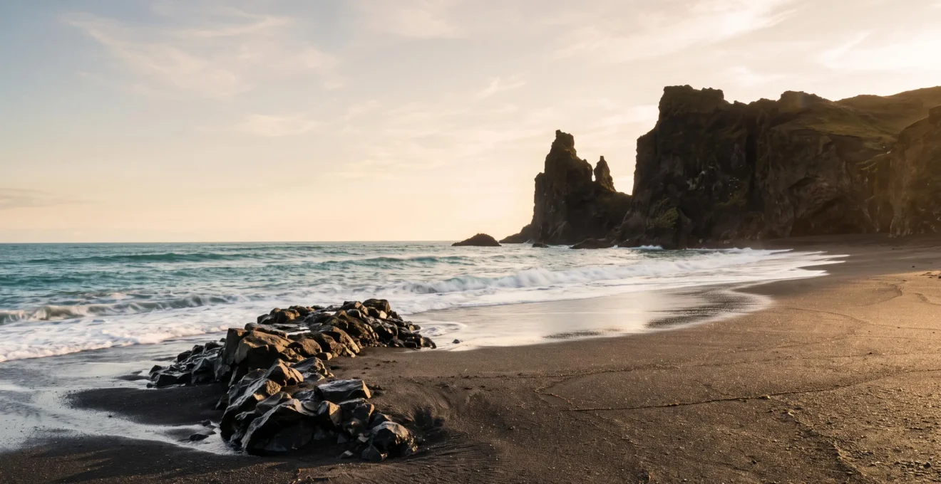
A volcanic island’s landscape is a direct record of its violent birth and slow erosion; you just need to learn the language to read it.
- Rock colour and texture reveal the temperature and violence of ancient eruptions.
- Layered cliffs act as timelines, with the oldest events recorded at the bottom.
Recommendation: Start seeing landscapes not just for their beauty, but as a story waiting to be decoded on your next trip.
Standing on a black sand beach is a visceral experience. The dark, heavy grains feel different, ancient. Most travellers know the simple fact: this sand comes from a volcano. They might take a photo, marvel at the contrast with the white foam of the waves, and move on. But in doing so, they are walking past the opening chapter of an epic story, a narrative of immense heat, pressure, and time written into the very ground beneath their feet.
Many guides will point to the dramatic cliffs and tell you they are volcanic. They might even mention the names of different rock types. But they rarely give you the tools to understand what you’re truly seeing. They teach you to spectate, not to read. What if the colour of a rock could tell you the temperature of an eruption that happened a million years ago? What if the shape of an island on the horizon could reveal whether it is a geological infant or a weathered old giant?
This guide goes beyond the surface. It’s for the curious traveller who wants to become a landscape detective. We will abandon the passive role of the tourist and adopt the mindset of a field geologist. This is not just about appreciating beauty; it’s about understanding origin. We will break down the “geological alphabet,” a set of visual clues in the rock, sand, and landforms, that will allow you to decode the volcanic history of the islands yourself. By the end, you won’t just see a landscape; you’ll read its biography.
This article provides the fundamental keys to unlock these geological stories. We will explore how to interpret everything from the texture of lava rock to the overall shape of an island, turning your next hike into a journey through deep time. The following sections are your field manual for this geological exploration.
Summary: Decoding the Volcanic Narrative of an Island
- Why Basalt Formations Reveal Eruption Temperatures Exceeding 1200°C
- How to Read Lava Formations and Identify Eruption Ages
- Basaltic vs Phonolitic Lava: What Island Rock Colours Reveal About Eruption Temperatures
- The Hiking Mistake Near Volcanic Craters That Traps 40% of Unprepared Trekkers
- How to Photograph Volcanic Landscapes Without Losing Dramatic Texture
- Why Saharan Sand Travelled 400km Across Ocean to Form Island Dunes
- How to Locate Natural Thermal Pools Without Commercial Development
- Why the Oldest Islands Emerged 20 Million Years Before the Youngest
Why Basalt Formations Reveal Eruption Temperatures Exceeding 1200°C
The iconic black sand of a volcanic beach is made of basalt, a rock born from lava. But not all lava is the same. The texture of the rock you see is a direct thermal signature, a frozen record of the eruption’s heat. The two most famous Hawaiian terms for lava, pāhoehoe (smooth, ropy) and ʻaʻā (jagged, clinkery), aren’t just descriptions; they are indicators of temperature and viscosity. Hot, fluid lava forms smooth pāhoehoe, while cooler, stickier lava breaks into the treacherous rubble of ʻaʻā. This transition isn’t arbitrary; research shows the shift from smooth pāhoehoe to jagged ʻaʻā typically happens once lava cools below roughly 1200°C.
You can become a thermal detective yourself. When examining a basalt flow, look for clues. A glossy, glass-like sheen indicates the lava cooled almost instantly, often where it hit the cold ocean. But the most telling clue can be tiny green crystals embedded in the dark rock. This is olivine, a mineral with a very high melting point. As the Geology.com editorial team notes in their article on the mineral, “Olivine has a very high crystallization temperature compared to other minerals.” Finding these emerald-green specks means you’re looking at rock that formed in incredibly high temperatures, where olivine could crystallise from the magma and survive the journey to the surface.
How to Read Lava Formations and Identify Eruption Ages
Volcanic islands are built layer by layer, with each eruption adding a new sheet of rock to the pile. For a landscape detective, this layering is a gift. It allows you to read the relative age of geological events using a fundamental concept called the Principle of Superposition. In any undisturbed stack of layers, the one at the bottom is the oldest, and the one at the top is the youngest. You don’t need a lab; you just need a good view of a cliff face, a road cutting, or a coastal sea-stack. By identifying the different layers, you can piece together a timeline of the area’s volcanic history, distinguishing between ancient flows and more recent events.
Is a layer perfectly horizontal? The eruption occurred on flat ground. Is it tilted or folded? That means powerful geological forces moved the ground *after* the lava had already solidified. By tracing these layers across the landscape, you can map the extent of a single eruption that may have happened hundreds of thousands of years ago. It’s the closest you can get to watching geological history play out in slow motion.
Case Study: Reading Time in a Hawaiian Park
A simple but powerful example from Hawaii Volcanoes National Park teaches this very principle. Observers are shown a photograph of a paved road next to a solid lava flow and asked a simple question: which came first? By applying the Principle of Superposition, the answer is obvious. The lava flow sits *on top of* a portion of the road, meaning the eruption that created the flow happened after the road was built. This demonstrates how you can use simple observation to establish a sequence of events in the field.
Basaltic vs Phonolitic Lava: What Island Rock Colours Reveal About Eruption Temperatures
While most of us think of volcanic rock as black basalt, the reality is a much richer and more informative palette. The colour and type of volcanic rock are dictated by its chemical composition, specifically its silica content. Low-silica lava, like basalt, is dark, runny, and hot. It creates the vast, dark shield volcanoes. But as magma sits in a chamber beneath the earth, it can evolve. It can become richer in silica, which changes everything. As the VolcanoDB research team explains, “More silica means higher viscosity, lower temperature, thicker flows, and more explosive eruptions.”
This evolved, high-silica magma produces lighter-coloured rocks, like pale grey phonolite or even whitish rhyolite. When you see a landscape dominated by these lighter rocks, you’re looking at evidence of a different kind of volcanism—cooler, stickier, and often far more violent. A pale, steep-sided volcanic peak tells a story of explosive eruptions, not gentle flows. The colour of the rock is a direct clue to the chemistry of the magma and the temperament of the volcano that produced it. The landscape’s colour palette—from black to grey to red (from oxidation) and yellow (from sulfur deposits)—is your key to understanding the volcano’s history and personality.
This variety of textures and hues isn’t random; it’s a geological library. Each colour and grain tells a story of heat, chemistry, and cooling speed, allowing you to read the history of an eruption in the palm of your hand. The transition from dark to light rock in a landscape signals a fundamental shift in the volcanic system beneath.
The Hiking Mistake Near Volcanic Craters That Traps 40% of Unprepared Trekkers
The allure of a volcanic crater is powerful, but the terrain surrounding it is unlike any other. The most common and dangerous mistake hikers make is underestimating the ground itself, particularly fields of ʻaʻā lava. From a distance, a field of black rock might look like a simple, if uneven, plain. But up close, ʻaʻā is a chaotic maze of sharp, glassy, and unstable blocks. It is not solid ground. Trekkers who leave the marked trail, assuming they can take a “shortcut” across such a field, find themselves in a perilous situation. Their progress slows to a crawl, and the sharp surface can shred sturdy hiking boots in minutes, let alone lightweight trainers. What looked like a 30-minute walk can easily become a multi-hour ordeal, leading to exhaustion, dehydration, and injury.
The misjudgment is a direct result of not understanding the geology. The surface of an ʻaʻā flow is a jumble of broken clinker that constantly shifts underfoot.
Case Study: The Deceptive Nature of ʻAʻā Fields
Field descriptions of ʻaʻā terrain consistently highlight a key feature: the flow consists of a dense, slowly moving core hidden beneath a loose layer of sharp, broken clinker. This makes crossing it exceptionally difficult and slow compared to the relatively stable, smooth surface of pāhoehoe. This geological difference is precisely why unprepared trekkers, accustomed to more stable ground, routinely misjudge the time and effort required for a crater approach, turning a planned hike into an unplanned survival situation.
Navigating these landscapes requires respect for the geology and strict adherence to safety protocols. A simple checklist can be the difference between a memorable hike and a mountain rescue.
Your Field Safety Checklist: Navigating Lava Terrains
- Stay only on marked, established trails whenever you are walking through an active or recently active volcanic area.
- Never step onto a lava flow that is only a few weeks old; a thin crust can hide molten rock and collapse without warning.
- Wear sturdy, thick-soled boots before crossing any ʻaʻā field; the sharp clinker surface can shred footwear.
- Treat any low-lying hollow or depression near a crater with caution, as invisible, heavier-than-air volcanic gases can silently pool there.
How to Photograph Volcanic Landscapes Without Losing Dramatic Texture
Photographing volcanic landscapes presents a unique challenge. The sheer scale can be overwhelming, and the often-monochromatic nature of basalt fields can look flat and uninteresting in a photo if not handled correctly. The key is to stop thinking about a single grand vista and start focusing on light, texture, and scale—the very elements a geologist uses to read the land.
First, chase the light. The harsh midday sun flattens texture. The best time to shoot is during the “golden hours”—the first hour after sunrise and the last hour before sunset. The low, angled light rakes across the landscape, picking out every crease in a ropy pāhoehoe flow and casting deep shadows behind the jagged blocks of an ʻaʻā field. This light transforms a flat black surface into a three-dimensional tapestry.
Second, play with scale. A vast lava field can be hard for a viewer to comprehend. Solve this by including a familiar object in your frame. A person walking on a path, a lone hardy plant, or even your own hiking boot placed on the rock can provide an immediate sense of scale, highlighting the immense size of the geological features. Juxtapose wide shots with macro details. After capturing the panoramic view, get down low and photograph the tiny olivine crystals, the glassy sheen on a shard of obsidian, or the pattern of cooling cracks in the basalt. This combination of macro and micro tells a more complete story.
Why Saharan Sand Travelled 400km Across Ocean to Form Island Dunes
Not all sand on an Atlantic volcanic island is born from fire. Some of the most spectacular dunes, great shifting seas of golden sand, have an entirely different and even more epic origin story. This sand is not volcanic; it’s continental. It is dust and sand from the Sahara Desert, carried over 400 kilometres across the open ocean by powerful, high-altitude winds.
This phenomenon, known as the Saharan Air Layer or “Calima,” is a dramatic meteorological event. Several times a year, massive dust storms in North Africa lift millions of tonnes of fine sediment into the atmosphere. Caught in the trade winds, this vast plume of dust travels westward, creating a hazy, otherworldly sky over the islands. Over thousands of years, as these winds reach the landmass of the islands, they slow down and deposit their load. This aeolian (wind-borne) process has slowly but surely built vast dune systems, creating Saharan landscapes in the middle of the Atlantic.
This is a powerful reminder that an island’s geology is not just about what rises from below, but also what arrives from afar. When you stand on these golden dunes, you are standing on a piece of another continent. The contrast between the black, volcanic rock of the island’s core and the pale, wind-swept sand of the dunes tells a story of two different geological engines at work: the volcanic fire from the Earth’s mantle and the relentless power of the planet’s atmosphere.
How to Locate Natural Thermal Pools Without Commercial Development
The same volcanic forces that build islands also leave behind a lingering thermal legacy. Even on islands where volcanic activity ceased millions of years ago, the geothermal gradient—the way heat from the Earth’s core rises to the surface—can still be strong enough to heat groundwater. This creates natural thermal pools, hidden gems for the adventurous traveller looking to connect with the island’s living geology. But how do you find them without heading to a developed spa?
You must follow the geological clues. The first is to think like water. Rainwater seeps deep into the volcanic rock, where it is heated before rising back to the surface along faults and fractures. Look for these pools in geologically active zones, often near old fault lines or the coast, where the freshwater can mix with seawater. The second clue is sensory: your nose. The faint smell of sulphur (like rotten eggs) is a tell-tale sign of geothermal activity, as volcanic gases dissolve in the heated water. This often indicates you are in the right area.
The most practical way to find these spots is to explore coastal rock pools at low tide. In some areas, geothermally heated water seeps out at the shoreline, creating natural hot tubs right at the ocean’s edge. Finding a rock pool that is significantly warmer than the surrounding sea is an exhilarating discovery. These are not just pools; they are direct, tangible connections to the heat that still resides deep within the island’s volcanic heart, a warm reminder of a fiery past.
Key Takeaways
- Lava’s texture is a fossilised thermometer; smooth means hotter (>1200°C), jagged means cooler.
- Rock layers are a timeline; in any undisturbed cliff, the bottom layer is the oldest.
- An island’s shape reveals its age; young volcanoes are steep and sharp, old ones are low and eroded.
Why the Oldest Islands Emerged 20 Million Years Before the Youngest
Not all volcanic islands in a chain are born at the same time. Many archipelagos, like the Hawaiian or Canary Islands, form as a tectonic plate slowly drifts over a stationary “hotspot” in the Earth’s mantle. This process creates a conveyor belt of islands, with the youngest and most active volcano sitting directly over the hotspot, and a chain of progressively older, more eroded, and dormant islands stretching away in the direction of the plate’s movement. This can create age differences of 20 million years or more between the oldest and youngest islands in the same group.
The life of an island begins in darkness, deep beneath the ocean. As the Volcano World team at Oregon State University explains, underwater eruptions create unique formations. Their research notes that “Pillow lavas…make up the submarine portion of seamounts and large intraplate volcanoes.” After thousands of these eruptions, the seamount finally breaches the surface, and an island is born. From that moment on, it is a battle between two forces: volcanic construction, which builds the island up, and erosion, which tears it down.
On a young island, construction wins. Eruptions are frequent, and it grows into a tall, steep-sided peak. On an old island, far from the hotspot, the volcanic engine has shut down. Now, erosion is the dominant force. Millions of years of wind, rain, and waves relentlessly grind the island down, transforming the sharp peak into a low, flat, gentle landscape. The shape of an island on the horizon is, therefore, its birth certificate. A sharp, conical silhouette screams “youth,” while a low, rounded profile whispers of ancient age and a long, slow surrender to the sea.
The next time you stand on a shoreline, whether it’s black volcanic sand or golden Saharan dust, look closer. The story of the Earth—of immense heat, unimaginable time, and the relentless forces of creation and destruction—is written there. Your journey as a landscape detective starts now.