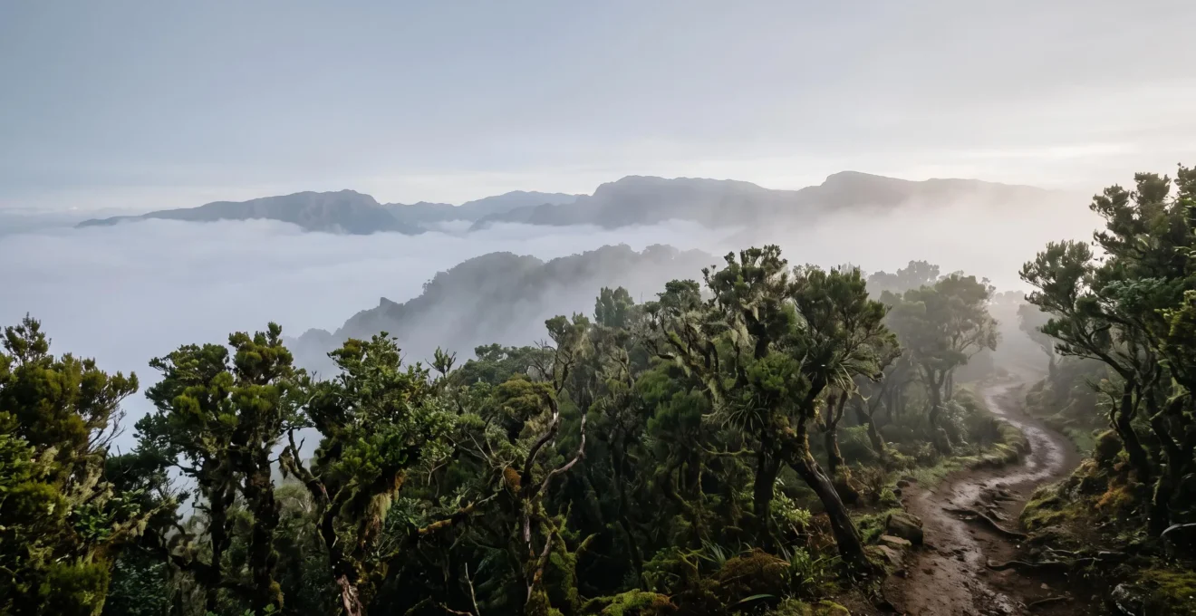
Beyond their ethereal beauty, the UNESCO designation of these laurel forests is not a simple nod to aesthetics. It is a formal recognition of a planetary-scale survival story, codified through stringent scientific criteria. This article deconstructs the precise reasons—from geological history to endemic biodiversity—that elevate these sites from mere forests to living museums of a lost world, justifying their status as irreplaceable assets for all humanity.
For the heritage-conscious traveller, the allure of a UNESCO World Heritage site lies in its promise of “outstanding universal value.” When confronted with the mist-shrouded, emerald depths of an Atlantic laurel forest, it is easy to attribute this value to the sheer, breathtaking beauty. The ancient, moss-covered trees, the ethereal silence broken only by dripping water, and the sense of stepping into a prehistoric world are profoundly moving. Many beautiful forests exist, however, yet few are inscribed on this prestigious list.
The common understanding is that these are simply ancient, well-preserved woodlands. But this perception barely scratches the surface. The real justification for their planetary significance is a far more complex and compelling narrative, woven from the threads of paleoclimatology, evolutionary biology, and rigorous legal frameworks. It is a story of survival against astronomical odds, where oceanic islands acted as life rafts in a sea of geologic time, preserving an ecosystem that the rest of the world lost to the ravages of the Ice Ages.
This article moves beyond the scenic and into the significant. We will dissect the specific, non-negotiable criteria that UNESCO applies, explore the unique biological and geological phenomena these forests exhibit, and understand the layered systems of protection that ensure their survival. This is not just about where to go, but about understanding *why* you are there—to appreciate these forests not merely as a destination, but as a tangible link to a world that has otherwise vanished.
To fully grasp the significance of this designation, this article breaks down the core elements that constitute the “outstanding universal value” of these laurel forests. We will explore the scientific reasoning, the visitor experience, and the conservation challenges that define these unique sites.
Summary: Decoding the Universal Value of UNESCO’s Laurel Forests
- Why Only 6 Atlantic Laurel Forests Met UNESCO’s Strict Universality Criteria
- How to Access Garajonay’s Core Zones Using Authorised Trail Networks
- Guided Heritage Tours vs Independent Exploration: Which Reveals UNESCO Criteria?
- When to Visit for the Mythical Horizontal Rain Phenomenon
- The Navigation Error That Leads 40% Off-Trail in Dense Fog Conditions
- Why Ice Ages Eliminated Laurel Forests Everywhere Except Oceanic Islands
- Why UNESCO and EU Designations Layer Multiple Protection Levels
- Why These Forests Vanished From Continents 10,000 Years Ago but Survived Here
Why Only 6 Atlantic Laurel Forests Met UNESCO’s Strict Universality Criteria
The UNESCO World Heritage List is not a collection of beautiful places; it is a register of sites that demonstrate “Outstanding Universal Value” (OUV). For a natural site, this means meeting stringent criteria related to natural phenomena, biodiversity, or Earth’s history. The laurel forests, or laurisilva, are a prime example of this rigor. They are not designated simply for being forests, but for being, in the words of the World Heritage Committee, an “outstanding and well-preserved example of laurisilva.” This phrasing is key; it implies a comparative standard that most remnants fail to meet.
The core of this exclusivity lies in the concept of integrity and endemism. It’s not enough to have laurel trees; a site must represent a complete, functioning ecosystem that is a near-perfect snapshot of the Tertiary period. Garajonay National Park on La Gomera, for example, possesses a level of unique life that is almost unparalleled. According to its official site documentation, thirty-four of the park’s 450 vascular plant species are endemic to the island, with eight found only within the park’s boundaries. This concentration of unique life, a direct result of bio-geographic isolation, provides a powerful argument for its universal value.
Even among the few successful inscriptions, UNESCO demands a unique justification for each. This prevents redundancy and ensures every site on the list adds a distinct chapter to the story of our planet.
Case Study: The Laurisilva of Madeira – A Different Justification
The process proves that UNESCO evaluators demand a unique, non-redundant justification for each forest. When the Laurisilva of Madeira was inscribed in 1999, the committee decision was based on it containing the largest surviving relict of the virtually extinct laurisilva forest that was once widespread in Europe. This justification, focused on scale and its status as a remnant of a formerly widespread European ecosystem, is distinct from Garajonay’s, which leans more heavily on its exceptional preservation and high endemism. This shows that the path to designation requires a site to possess a unique, defensible argument for its global significance.
How to Access Garajonay’s Core Zones Using Authorised Trail Networks
Understanding the value of these forests leads to a desire to experience them, but access is a carefully managed affair. To protect the very integrity that earned them UNESCO status, large parts of Garajonay are designated as Integral Reserves, zones free from almost all human activity. This level of protection is a core part of the conservation strategy, preserving pristine areas for scientific research and ensuring the ecosystem’s natural processes continue undisturbed. For the heritage-conscious visitor, this means respecting that the most valuable parts of the park are those you cannot enter.
However, the park authority has designed an extensive network of authorised trails that allows for deep immersion without compromising the core zones. These trails are not random paths; they are carefully routed to showcase the forest’s diversity, from the misty peaks to the more humid, stream-fed valleys, while channelling visitor impact away from the most fragile areas. They represent a masterclass in balancing conservation with public access, allowing visitors to feel the magic of the geological relict without degrading it.
This network of paths provides the only sanctioned way to explore the heart of the laurisilva. Following them is not just a rule, but an act of participation in the site’s conservation.
As this image shows, the authorised trails are intentionally designed to be narrow and unobtrusive, winding through the dense foliage to create an experience of solitude and immersion while clearly delineating the boundary between access and preservation. Choosing a trail is the first step in a responsible visit.
Your Action Plan: Navigating Garajonay’s Trail Network
- Plan your route: Decide between options like the popular 4.8-kilometre ramble from El Contadero to El Cedro or the more comprehensive 12.7-kilometre circular trail from Pajaritos for a full-day immersion.
- Consider a guided tour: Reserve a free guided route at the Juego de Bolas visitor centre for expert interpretation and potential access to less-trodden sections.
- Verify trail status: Always confirm the current status of your chosen trail at an official visitor centre before setting out, as closures for maintenance or weather are possible.
- Respect the boundaries: Stay strictly on the marked paths. The wooden stakes and signs are there to protect both the visitor from getting lost and the fragile ecosystem from being trampled.
- Leave no trace: Pack out everything you pack in. The pristine nature of the forest is its most valuable asset, and maintaining it is a shared responsibility.
Guided Heritage Tours vs Independent Exploration: Which Reveals UNESCO Criteria?
Once you have committed to the authorised trail network, the next decision is how to interpret what you are seeing. Do you explore independently, relying on your own research and observation, or do you join a guided tour for expert context? For the heritage-conscious traveller, the answer depends on which aspect of the UNESCO criteria you wish to uncover. Independent exploration offers solitude and a personal connection to the landscape, allowing you to experience the “exceptional natural beauty” criterion on your own terms. It fosters a sense of discovery as you identify species with a field guide or simply sit in silence, absorbing the ancient atmosphere.
However, many of the deeper criteria—the geological history, the specific ecological relationships, and the cultural context like the Silbo Gomero whistled language—are not immediately visible. A park-licensed guide acts as an interpreter, translating the silent forest into a rich narrative. They can point out the subtle differences between laurel species, identify the call of an endemic pigeon, and explain how the horizontal rain sustains the entire ecosystem. This transforms a beautiful walk into a lesson in living history, directly connecting the visitor to the scientific reasons for the site’s “Outstanding Universal Value.”
Ultimately, the “best” method is the one that aligns with your travel philosophy. Do you seek quiet contemplation or deep, contextual knowledge? The following table breaks down the trade-offs to help you decide which path will be more rewarding for your journey into this planetary asset.
| Criterion | Guided Heritage Tour | Independent Exploration |
|---|---|---|
| Access to restricted core zones | Possible with a park-licensed guide into zones closed to independent walkers | Limited to open, waymarked public trails only |
| Scientific interpretation | Guide identifies endemic species and explains geological history on-site | Depends entirely on visitor’s prior research or a field guide |
| Group format | Official park guided route offered only in small groups, primarily in Spanish | Solo or self-paced small groups, any language |
| Cultural elements | May include live demonstrations such as the Silbo Gomero whistled language | Requires separate visit to a cultural site or museum |
When to Visit for the Mythical Horizontal Rain Phenomenon
One of the most critical phenomena that defines the laurisilva is not rain that falls from above, but moisture that moves sideways. The trade winds, saturated with Atlantic humidity, are forced up the mountainsides of the Canary Islands. As the air cools, the moisture condenses into a dense, ground-hugging fog. This fog, driven by the wind, moves directly through the forest canopy. The leaves and branches of the laurel trees act as a massive comb, capturing the tiny water droplets from the air. This process, known locally as lluvia horizontal or “horizontal rain,” is the lifeblood of the ecosystem.
This phenomenon is not just a quaint weather curiosity; it is a fundamental ecological mechanism that allowed these forests to survive when their continental counterparts perished. It provides a constant, reliable source of moisture that decouples the forest from seasonal rainfall patterns, creating the stable, humid microclimate necessary for the laurisilva and its myriad of ferns and mosses to thrive. Witnessing it is to see the engine of this climatic refuge in action. To experience it, you must visit when the conditions are right—typically during the cooler, wetter months from autumn to spring, when the trade winds are most consistent and condensation is at its peak. Visiting in the early morning often provides the best chance to be enveloped in the life-giving mist.
The visual evidence of horizontal rain is stunning. Droplets form on every surface, channelling water down stems and trunks to the forest floor, a far more efficient irrigation system than conventional rain. This constant drip-feed of moisture is what sustains the lush, green world that feels so ancient and permanent.
The Navigation Error That Leads 40% Off-Trail in Dense Fog Conditions
The same dense fog that creates the magical “horizontal rain” is also the source of the single greatest risk for hikers in Garajonay: disorientation. Visibility can drop to a few meters in minutes, transforming a clearly marked trail into a confusing maze of similar-looking trees and faint paths. In these conditions, modern hikers instinctively reach for their GPS or smartphone. This is a critical, and potentially dangerous, mistake. The common assumption is that technology will provide a reliable backup, but in the unique environment of a laurel forest, this assumption fails.
The problem is twofold. First, the dense, multi-layered canopy of the laurisilva acts as a significant physical barrier, blocking the weak signals from GPS satellites. Second, the very high water content of the fog and the leaves themselves further absorbs and scatters these radio waves. A forestry study on GPS reliability under canopy cover provides a stark warning: it found that once 33% of the sky view is blocked the unit performs half as well. In Garajonay’s dense fog, where sky-view obstruction can approach 80-90%, GPS devices become notoriously unreliable or fail completely precisely when they are needed most.
The critical navigation error, therefore, is not simply taking a wrong turn, but placing unjustified faith in technology within an environment that actively defeats it. This leads to a dangerous feedback loop: a hiker becomes disoriented, trusts their failing GPS, and is led further from the safety of the trail. The solution is ancient: trust a map, a compass, and the trail markers. This reliance on traditional methods is not a nostalgic preference; it is a practical necessity dictated by the physics of this unique World Heritage environment.
Why Ice Ages Eliminated Laurel Forests Everywhere Except Oceanic Islands
To understand the irreplaceability of these forests, one must look back millions of years. During the Tertiary Period, this type of humid, subtropical forest was widespread across much of Southern Europe and North Africa. It was the dominant ecosystem of its time. However, the subsequent Pleistocene Ice Ages triggered dramatic climate shifts. As glaciers advanced and the global climate cooled and dried, these moisture-dependent forests were pushed to the brink. On the continents, they had nowhere to go and were almost entirely wiped out, surviving only in tiny, fragmented pockets.
Oceanic islands like the Canaries and Madeira, however, acted as climatic refuges. Their position in the Atlantic Ocean buffered them from the extreme temperature swings experienced on the continents. The ocean’s thermal mass created a stable microclimate, and the trade winds continued to deliver a steady supply of moisture, regardless of the glacial cycles elsewhere. Data confirms this stability; Garajonay receives more than 31 inches (800 mm) of rainfall annually, a consistent regime that continental forests lost long ago. These islands became life rafts, preserving a snapshot of a lost world.
However, climatic stability alone was not enough to guarantee their long-term survival into the modern era. The same forests that survived the Ice Ages later faced a new threat: humanity.
Case Study: Human Pressure as a Modern Extinction Threat
According to an IUCN assessment, the establishment of Garajonay National Park was a critical intervention that prevented the loss of the largest remnant of Laurel forest in the Canary Islands. The area had suffered for centuries from human impacts such as logging for timber, firewood production, and the conversion of forest land for agriculture. This illustrates a crucial point: oceanic isolation provided a refuge from climate change, but it offered no protection from human activity. Without the active, deliberate protection provided by national park status and, later, UNESCO designation, even these Ice Age survivors would have likely vanished.
Why UNESCO and EU Designations Layer Multiple Protection Levels
The “irreplaceable” status of these forests is not just a title; it is backed by a complex web of legal protections. A single designation is often not enough to safeguard a site from the myriad of potential threats, from illegal development to invasive species. This is why sites like Garajonay are wrapped in multiple, overlapping layers of legal and environmental jurisprudence. It begins at the national level; as a foundational step, Garajonay was first declared a Spanish National Park. This provided the core legal framework for its management and conservation.
On top of this national layer, regional and international designations are added, each bringing its own set of standards, resources, and legal weight. Designation as an EU Natura 2000 site, for example, focuses specifically on biodiversity, requiring the state to manage the area to protect key habitats and species. The UNESCO World Heritage designation sits at the apex of this structure. It is a global recognition that elevates the site’s importance beyond national interest, declaring it part of the common heritage of all humanity. This layered jurisprudence creates a robust defense, where the strengths of one designation can cover the weaknesses of another.
This multi-layered shield is not a bureaucratic exercise; it is a pragmatic strategy to ensure that these living museums are protected in perpetuity. However, even this formidable legal armour is not perfect.
Case Study: Where the Protection Layers Still Fall Short
Even with this comprehensive protection, gaps can persist. A formal IUCN report on Garajonay noted that certain subtypes of laurel forest on La Gomera are not yet represented within the park’s boundaries. The report suggests that it would be beneficial to extend the site to include these adjacent areas of high conservation value. This demonstrates that conservation is not a one-time fix. The need for continual reassessment and advocacy is ongoing, even for a site with the highest levels of global protection. The work of safeguarding these planetary assets is never truly finished.
Key Takeaways
- Irreplaceability is defined by science, not scenery: UNESCO designation hinges on strict criteria of ecosystem integrity, endemism, and status as a ‘geological relict’.
- Oceanic islands acted as climatic life rafts: Their stable microclimates allowed laurisilva to survive the Ice Ages that wiped out their continental counterparts.
- Protection requires a multi-layered legal shield: National Park, EU, and UNESCO designations work together to create a robust defense, but constant vigilance is still required.
Why These Forests Vanished From Continents 10,000 Years Ago but Survived Here
The story of the laurel forests is ultimately a tale of two outcomes. On the vast continents of Europe and Africa, the story is one of loss. The climatic upheaval of the Ice Ages was a force that these forests, dependent on stability and humidity, could not withstand. They were outcompeted, frozen, and dried out of existence, leaving behind only fossil records and a few tiny, isolated pockets as a ghost of their former range. Their disappearance was the rule, a predictable outcome of planetary-scale climate change. Their survival, therefore, is the profound exception.
That exception was written in the geology of the Macaronesian islands. As high volcanic peaks, they were positioned to be the “first to receive the rains arriving from the west.” This unique geographic position allowed them to continuously intercept the moisture-laden trade winds, creating a self-sustaining system of “horizontal rain” that insulated them from the widespread drying that doomed their continental relatives. They survived not because they were stronger, but because their location provided a unique and persistent climatic refuge—a safe harbor in the storm of global climate change. In a very real sense, these islands are the reason this ecosystem still exists for us to experience.
The UNESCO designation is therefore not just an honour, but a recognition of this incredible accident of geography and time. It acknowledges that these forests are not just old, but are survivors of a global extinction event—the living, breathing remnants of a world that no longer exists anywhere else. They are, as the World Heritage Committee stated, “the largest surviving relict of the virtually extinct laurisilva forest type.”
To visit these forests is therefore to do more than hike a beautiful trail; it is to walk through a living museum of deep time. The informed traveller’s role shifts from that of a consumer of scenery to that of a respectful witness to a multi-million-year-old survival story. Approaching these sites with an understanding of their profound global significance is the greatest tribute one can pay to these irreplaceable planetary assets.